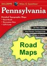
Home » US Maps » Pennsylvania » Roads and Cities
Map of Pennsylvania Cities and Roads

ADVERTISEMENT
City Maps for Neighboring States:
Delaware Maryland New Jersey New York Ohio West Virginia


Pennsylvania Cities:
Cities with populations over 10,000 include: Aliquippa, Allentown, Altoona, Beaver Falls, Berwick, Bethel Park, Bethlehem, Bloomsburg, Bristol, Butler, Carlisle, Chambersburg, Chester, Coatesville, Columbia, Darby, Drexel Hill, Dunmore, East Stroudsburg, Easton, Elizabethtown, Emmaus, Ephrata, Erie, Franklin Park, Greensburg, Hanover, Harrisburg, Hazleton, Hermitage, Indiana, Jeannette, Johnstown, Kingston, Lancaster, Lansdale, Lebanon, Lower Burrell, Meadville, Munhall, Nanticoke, New Castle, New Kensington, Norristown, Oil City, Phoenixville, Philadelphia, Pittsburgh, Plum, Pottstown, Pottsville, Reading, Saint Marys, Scranton, Sharon, State College, Sunbury, Uniontown, Washington, Weigelstown, West Mifflin, Wilkes-Barre, Williamsport, Woodlyn and York.
Pennsylvania Interstates:
North-South interstates include: Interstate 79, Interstate 81 and Interstate 83. East-West interstates include: Interstate 70, Interstate 76, Interstate 78, Interstate 83 and Interstate 90.
Pennsylvania Routes:
US Highways and State Routes include: Route 6, Route 11, Route 15, Route 19, Route 22, Route 30, Route 40, Route 62, Route 119, Route 209, Route 219, Route 220, Route 322, Route 422 and Route 522.
ADVERTISEMENT

