Home » US Maps » Utah » Roads and Cities
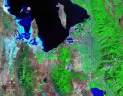
Map of Utah Cities and Roads

ADVERTISEMENT
City Maps for Neighboring States:
Arizona Colorado Idaho Nevada New Mexico Wyoming


Utah Cities:
Cities with populations over 10,000 include: American Fork, Brigham City, Cedar City, Centerville, Clinton, Draper, Farmington, Kaysville, Layton, Lehi, North Ogden, Ogden, Orem, Payson, Provo, Riverton, Salt Lake City, Sandy, South Ogden, Spanish Fork, Springville, Tooele, West Jordan and West Valley City.
Utah Interstates:
North-South interstates include: Interstate 15. East-West interstates include: Interstate 70, Interstate 80 and Interstate 84.
Utah Routes:
US Highways and State Routes include: Route 6, Route 40, Route 50, Route 89, Route 91, Route 163, Route 189, Route 191 and Route 491.
ADVERTISEMENT

