Home » US Maps » Wisconsin » Roads and Cities
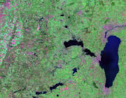
Map of Wisconsin Cities and Roads

ADVERTISEMENT
City Maps for Neighboring States:
Illinois Iowa Michigan Minnesota


Wisconsin Cities:
Cities with populations over 10,000 include: Allouez, Appleton, Ashwaubenon, Beaver Dam, Beloit, Brown Deer, Cedarburg, Chippewa Falls, De Pere, Eau Claire, Fitchburg, Fond du Lac, Fort Atkinson, Franklin, Germantown, Green Bay, Howard, Janesville, Kaukauna, Kenosha, La Crosse, Madison, Manitowoc, Marinette, Marshfield, Menasha, Menomonee Falls, Menomonie, Mequon, Merrill, Milwaukee, Monroe, Muskego, Neenah, Oak Creek, Oconomowoc, Onalaska, Oshkosh, Pleasant Prairie, Plover, Port Washington, Racine, River Falls, Sheboygan, South Milwaukee, Stevens Point, Stoughton, Sun Prairie, Superior, Two Rivers, Watertown, Waukesha, Wausau, West Allis, West Bend, Whitewater and Wisconsin Rapids.
Wisconsin Interstates:
North-South interstates include: Interstate 43 and Interstate 93. East-West interstates include: Interstate 90 and Interstate 94.
Wisconsin Routes:
US Highways and State Routes include: Route 2, Route 8, Route 10, Route 12, Route 14, Route 18, Route 41, Route 45, Route 51, Route 53, Route 61, Route 63, Route 141 and Route 151.
ADVERTISEMENT

