Home » US Maps » Delaware » County Map
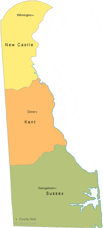
Delaware County Map with County Seat Cities
ADVERTISEMENT
County Maps for Neighboring States:
Maryland New Jersey Pennsylvania


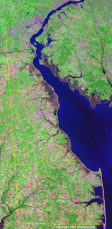
The map above is a Landsat satellite image of Delaware with County boundaries superimposed. We have a more detailed satellite image of Delaware without County boundaries.


ADVERTISEMENT
Delaware Counties and County Seats |
|
|
Kent County - Dover New Castle County - Wilmington |
Sussex County - Georgetown |
