Home » US Maps » Vermont » County Map
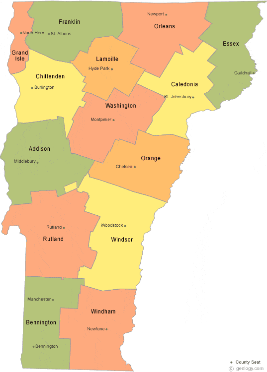
Vermont County Map with County Seat Cities
ADVERTISEMENT
County Maps for Neighboring States:
Massachusetts New Hampshire New York


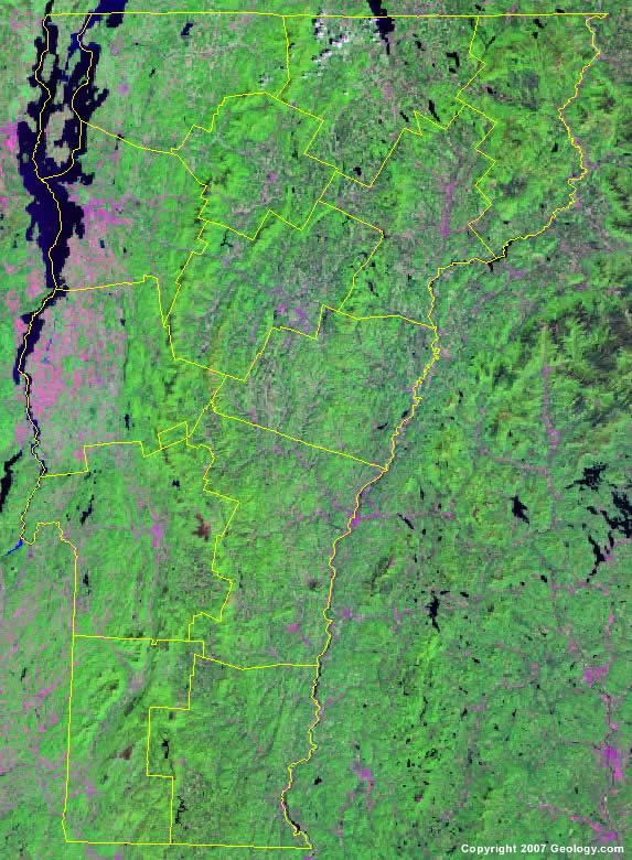
The map above is a Landsat satellite image of Vermont with County boundaries superimposed. We have a more detailed satellite image of Vermont without County boundaries.


ADVERTISEMENT
Vermont Counties and County Seats |
|
|
Addison County - Middlebury Bennington County - Bennington, Manchester Caledonia County - St. Johnsbury Chittenden County - Burlington Essex County - Guildhall Franklin County - St. Albans Grand Isle County - North Hero |
Lamoille County - Hyde Park Orange County - Chelsea Orleans County - Newport Rutland County - Rutland Washington County - Montpelier Windham County - Newfane Windsor County - Woodstock |
