Home » US Maps » Tennessee » Lakes and Rivers
Tennessee Lakes, Rivers and Water Resources
ADVERTISEMENT
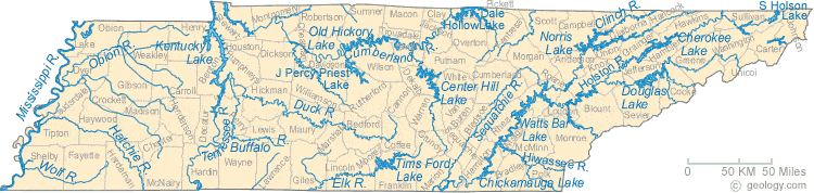
Tennessee Rivers Shown on the Map: Buffalo River, Clinch River, Cumberland River, Duck River, Elk River, Hatchie River, Hiwassee River, Holston River, Mississippi River, Obion River, Sequatchie River, Tennessee River and Wolf River.
Tennessee Lakes Shown on the Map: Center Hill Lake, Cherokee Lake, Chickamauga Lake, Dale Hollow Lake, Douglas Lake, J. Percy Priest Lake, Kentucky Lake, Norris Lake, Old Hickory Lake, South Holston Lake, Tims Ford Lake and Watts Bar Lake.
| Tennessee Stream and River Levels |
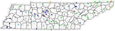 The United States Geological Survey has a number of stream gages located throughout Tennessee. These estimate stream levels, discharges and record them over time. This data is published on the web and many stations allow users to plot custom graphs. Get updated Tennessee river and stream levels from USGS here.
| Tennessee Stream and River Level Alerts |
 The United States Geological Survey has a system that will send you an email message when flood levels are reached on any steam with USGS gaging equipment that you have selected. Sign up here to recieve Tennessee stream and river level alerts.

| Tennessee Drought Map |
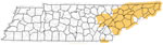 The United States Geological Survey publishes updated drought maps on their website. There you can view a map that shows where below normal 7-day average stream flow conditions were recently recorded. The maps are updated daily. Get a current Tennessee drought map here.
| Tennessee Water Publications |
 The United States Geological Survey has a number of publications related to water use and water resources in Tennessee. Visit the Lower Mississippi-Gulf Water Science Center here.
| Tennessee Elevation Map |
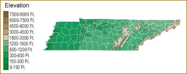 The topography of an area determines the direction of stream flow and often is a primary influence on the geographic distribution of precipitation. View a detailed Tennessee elevation map.


Find Other Topics on Geology.com:

|

| ||

|

| ||

|

| ||

|

|