Home » Satellite Images » US States » Iowa
Satellite Image of Iowa
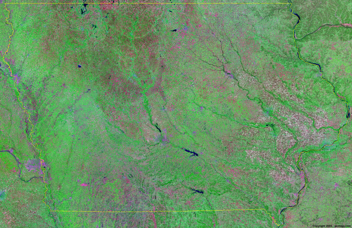
Iowa Satellite Image - View Cities, Rivers, Lakes & Environment
Satellite Images for Neighboring States:
Illinois Minnesota Nebraska South Dakota WisconsinThis is a Landsat GeoCover 2000 satellite image map of Iowa. Cities, rivers, lakes, mountains and other features shown in this image include:
Iowa Cities:
Ames, IA
Cedar Rapids, IA
Council Bluffs, IA
Davenport, IA
Des Moines, IA
Dubuque, IA
Fort Dodge, IA
Indianola, IA
Iowa City, IA
Marshalltown, IA
Mason City, IA
Oskaloosa, IA
Ottumwa, IA
Pella, IA
Sioux City, IA
Waterloo, IA
Iowa Rivers, Lakes, Water Features:
Cedar River
Chariton River
Clear Lake
Des Moines River
Five Islanad Lake
Iowa River
Lake Panorama
Lake Red Rock
Lost Island Lake
Mississippi River
Rathbun Lake
Rice Lake
Sayorville Lake
Shell Rock River
Storm Lake
Trumbull Lake
Turkey River
Twelve Mile Lake
Volga River
Wapsipinicon River
Other Prominent Iowa Features:
Iowa farm land
ADVERTISEMENT
More Satellite Images
 State Satellite Images: Color Landsat views of all 50 states. Spectacular images.
 Use Google Earth for FREE: Browse seamless worldwide satellite images. Free.
 Earth from Space at Night: Composite images show worldwide patterns of night light and heat.
 Oil & Gas Fields from Space at Night: Drill pad lighting and flaring make them stand out at night.
 Country Satellite Images: Satellite images for over 170 countries from Landsat GeoCover data.
  Satellite Views of US Cities: Images of 120 cities and their surrounding environment.
 Land Below Sea Level: The top ten locations where land is below the level of the ocean.
  Satellite Views of 64 World Cities: Spectacular images showing the city and surrounding environment.
Copyright information: The images on this page were composed by Angela King and are copyright by Geology.com. These images are not available for use beyond our websites. If you would like to share them with others, please link to this page. The satellite image was produced using Landsat data from NASA.