Home » Satellite Images » US States » Washington
Satellite Image of Washington
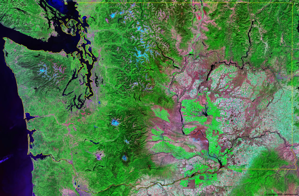
Washington Satellite Image - View Cities, Rivers, Lakes & Environment
Satellite Images for Neighboring States:
Idaho OregonThis is a Landsat GeoCover 2000 satellite image map of Washington. Cities, rivers, lakes, mountains and other features shown in this image include:
Washington Cities:
Arlington, WA
Bellevue, WA
Bellingham, WA
Everett, WA
Kennewick, WA
Longview, WA
Olympia, WA
Port Angeles, WA
Seattle, WA
Sedro-Wolley, WA
Spokane, WA
Tacoma, WA
Vancouver, WA
Wenatchee, WA
Yakima, WA
Washington Rivers, Lakes, Water Features:
Baker Lake
Banks Lake
Columbia River
Hood Canal
Lake Chelan
Lake Crescent
Lake Franklin D. Roosevelt
Lake Merwin
Lake Sacajawea
Lake Shannon
Lake Quinault
Lake Washington
Lake Whatcom
Mayfield Lake
Omak Lake
Ozette Lake
Palmer Lake
Pend Oreille River
Potholes Reservoir
Riffe Lake
Ross Lake
Silver Lake
Snake River
Swift Creek Reservoir
Yakima River
Yale Lake
Other Prominent Washington Features:
Cascade Range
Kettle River Range
Mount Adams
Mount Baker
Mount Rainier
Mount St. Helens
Olympic Mountains
Selkirk Mountains
Washington Farm Land
Wenatchee Mountains
ADVERTISEMENT
More Satellite Images
 State Satellite Images: Color Landsat views of all 50 states. Spectacular images.
 Use Google Earth for FREE: Browse seamless worldwide satellite images. Free.
 Earth from Space at Night: Composite images show worldwide patterns of night light and heat.
 Oil & Gas Fields from Space at Night: Drill pad lighting and flaring make them stand out at night.
 Country Satellite Images: Satellite images for over 170 countries from Landsat GeoCover data.
  Satellite Views of US Cities: Images of 120 cities and their surrounding environment.
 Land Below Sea Level: The top ten locations where land is below the level of the ocean.
  Satellite Views of 64 World Cities: Spectacular images showing the city and surrounding environment.
Copyright information: The images on this page were composed by Angela King and are copyright by Geology.com. These images are not available for use beyond our websites. If you would like to share them with others, please link to this page. The satellite image was produced using Landsat data from NASA.