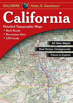
Complete California Road Map and Topographic Map Coverage
Makes a great gift
Large 11" x 15.5" Pages
Topo Maps with Back Roads
140 Pages of Maps
20 Pages of Attractions, Information and Places to Visit
Scale: 1:200,000 (1" = 3.16 miles)
Only $24.95
Ships right away by Priority Mail
A few ways to use this atlas are to:
Plan your weekend get-away to Yosemite
Find ski resorts around Lake Tahoe
Review recreational options at Los Padres National Forest
Plan things to see near San Jose on your next family outing
Atlas Covers and Cases
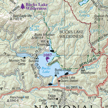
A Sample Map From This Book
Some of the Map Symbols
Campgrounds
Family Outings
Fishing
Outdoor Adventures
Unique Natural Features
Recreation Areas
Fishing Piers
Boat Launch
Golf Courses
Information Center
Lighthouse
Port of Entry
Get the entire state of California in 140 large pages of up-to-date, shaded relief maps in the DeLorme Atlas and Gazetteer! This atlas has an index of place names for easy look-up. The back cover of this atlas has a large map of California with an overlying grid. Each cell of the grid contains the page number for a detailed map of that area. Many physical and man-made features are detailed on each map. These include: mountains, passes, creeks, rivers, lakes, swamps, dunes, forests, railroads, reservoirs, roads, trails, highways and interstates. In addition, state-wide topographic information is shown by contour lines with intervals of 300 feet. A two-page map of Yosemite National Park is included in the 20 additional pages of special reference information which details the state’s activities and points of interest. The activities include: outdoor adventures, family outings, camping, biking, hiking, fishing, paddling and skiing. There are over five pages just for listing the state’s recreational areas and their various activities!
The details that the DeLorme Atlas and Gazetteer offers can help to plan your next vacation in California!
DeLorme Topo
View and print topographic maps for all 50 states and Canada!