geology Free printable topo maps

Home » Store » Delorme Atlas » Delaware

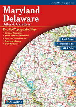
Delaware DeLorme Atlas


Complete Delaware Road Map and Topographic Map Coverage.


delorme atlas
Makes a great gift
Discover Delaware and Maryland in 61 pages of large up-to-date maps in this DeLorme Atlas and Gazetteer! This combined atlas shows each state’s topography by contour lines with intervals of 15, 50 or 100 feet, depending on the terrain. Numerous physical and man-made features on these maps include: lakes, rivers, creeks, reservoirs, dams, canals, islands, harbors, wetlands, forests, mountains, railroads, airports, place names, roads and highways. There are 19 pages of reference information given for the states’ points of interest and activities. These areas of interest include: unique natural features, hiking, public lands, canoe trips, hunting, campgrounds, historic sites, museums, gardens, scenic drives, bicycling and fishing. There are also several maps of Chesapeake Bay habitats showing areas for: some shellfish, aquatic vegetation, and other declining species.

Some suggested ways to use this atlas are to:
  • Find a hiking trail in the Brandywine Creek State Park
  • Learn recreational activities available at Treasure Beach
  • Explore historic sites in Wilmington!
  • Find fishing spots near Milford
Delaware and Maryland’s place names are indexed for easy look-up. The back cover of this atlas has a large map of Delaware and Maryland with an overlying grid. Each cell of the grid contains the page number for a detailed map of that area. The details available with this DeLorme Atlas and Gazetteer can help plan your next vacation!

Only $19.99

Ships right away by Priority Mail

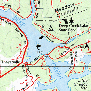
A Sample Map From This Book

sample map
Some of the Map Symbols

Delaware hiking Hiking
Delaware gardens Gardens
Delaware campgrounds Campgrounds
Delaware natural features Unique Natural Features
Delaware fishing Fishing
Delaware biking Bicycling
Delaware state lands State Lands
Delaware museums Museums
Delaware history Historic Sites
Delaware canoe trips Canoe Trips
Delaware scenic drives Scenic Drives
National lands in Delaware National Lands
 
Map Features
Large Pages (11" x 15.5")

1:100,000 scale

1" = 1.6 miles

61 pages of maps

80 pages in all

Grids and tick marks
other states
Covers and Cases
soft cover
Atlas Cover only $3.95


zip case
Atlas Zip Case only $12.95
© 2005-2009 Geology.com. All Rights Reserved.
Images, code and content of this website are property of Geology.com. Use without permission is prohibited. Pages on this site are protected by Copyscape.