Makes a great gift!
Kansas DeLorme Atlas
Complete Kansas Road Map and
Topographic Map Coverage
- Topo Maps with Back Roads
- 65 Pages of Maps
- 15 Pages of Attractions, Information and Places to Visit
- Scale: 1:200,000 (1" = 3.2 miles)
Here are just a few ways you can use this atlas:
|
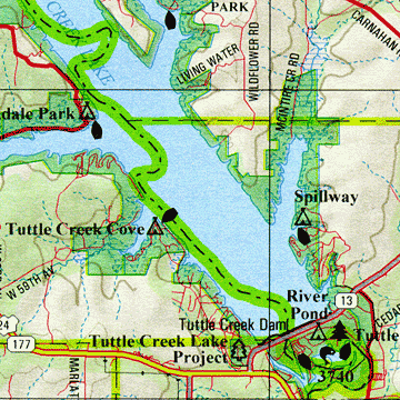
A Sample Map From This Book
Some of the Map Symbols
| Attractions | |
| Golf Courses | |
| Campgrounds | |
| Fishing | |
| Paddling | |
| Scenic Drives | |
| State Parks | |
| Wildlife Viewing | |
| Historic Sites | |
| Unique Natural Features | |
| Hiking | |
| Hunting | |
The detailed maps show physical and man-made features, such as lakes, rivers, reservoirs, creeks, towns, reservations, cities, airports, railroads, highways, interstates, roads, trails, parks, wildlife areas and oil fields. State-wide topographic information is shown by contour lines with intervals of 120 feet. With the extras and details this atlas has to offer, you can easily plan your next vacation to Kansas!