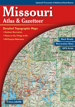
Complete Missouri Road Map and Topographic Map Coverage
Makes a great gift
Large 11" x 15.5" Pages
Topo Maps with Back Roads
58 Pages of Maps
14 Pages of Attractions, Information and Places to Visit
Scale: 1:200,000 (1" = 3.2 miles)
Only $19.99
Ships right away by Priority Mail
A few ways you can use this atlas are to:
Find kid-friendly activities while in Kansas City
Explore Onondaga Cave State Park
Map a hike on the Katy Trail
Plan your float trip on the Gasconade River
Atlas Covers and Cases
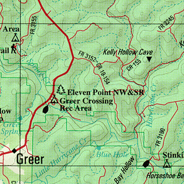
A Sample Map From This Book
Some of the Map Symbols
Attractions
Biking
Campgrounds
Fishing
Float Trips
Hiking
State Lands
Scenic Drives
Historic Sites
Hunting
Wineries
Unique Natural Features
Discover Missouri’s diverse terrain with the DeLorme Atlas and Gazetteer! This up-to-date atlas has 58 large pages of shaded relief maps and an index of place names and map features for easy look-up. The back cover of this atlas has a large map of Missouri with an overlying grid. Each cell of the grid contains the page number for a detailed map of that area. Numerous physical and man-made features are shown on these detailed maps. These include: lakes, rivers, creeks, valleys, caves, mountains, forests, railroads, roads, trails, highways, interstates, airports, place names, conservation areas and parks. The atlas has state-wide topographic information shown by contour lines with intervals of 120 feet. There are 14 additional pages of reference information for public lands, unique natural features, historic sites, attractions, wineries, fishing, hunting, campgrounds, hiking, biking, float trips and scenic drives.
There are so many details and extras you will not be disappointed with the DeLorme Atlas and Gazetteer!
DeLorme Topo
View and print topographic maps for all 50 states and Canada!