 Makes a great gift!
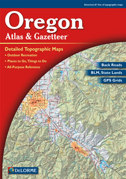
Oregon DeLorme Atlas
Complete Oregon Road Map and
Topographic Map Coverage
- Large 11" x 15.5" Pages
- Topo Maps with Back Roads
- 72 Pages of Maps
- 16 Pages of Attractions, Information and Places to Visit
- Scale pg 17-71: 1:150,000 (1" = 2.4 miles)
- Scale pg 72-88: 1:300,000 (1" = 4.8 miles)
Some ways to use this atlas are to:
- Find hiking trails in Crater Lake National Park
- Locate boat ramps on the Willamette River
- Explore Mt. Hood National Forest
- Find museums and science centers in Eugene
|
Ships right away by Priority Mail
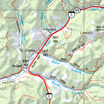
A Sample Map From This Book
Some of the Map Symbols
 |
Campgrounds |
 |
Scenic Drives |
 |
Boat Ramps/Fishing |
 |
Unique Natural Features |
 |
Hunting - Fish & Wildlife Offices |
 |
Oar/Paddle Trips
|
 |
Parks/Forests/Wilderness Areas |
 |
Hiking |
 |
Historic Sites/Museums |
 |
Bicycle Routes |
 |
Lighthouses |
 |
Information Centers |
These shaded relief maps have state-wide topographic information shown by contour lines with intervals of 300 feet or 600 feet, depending on the terrain. The DeLorme Atlas and Gazetteer has 16 additional pages of information on Oregon's recreation and points of interest. You will be impressed with what this atlas has to offer!