Makes a great gift!
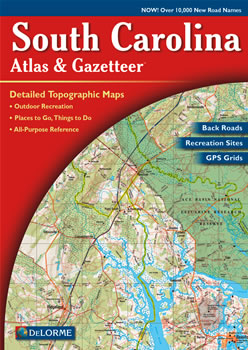
South Carolina DeLorme Atlas
Complete South Carolina Road Map and
Topographic Map Coverage
- Topo Maps with Back Roads
- 48 Pages of Maps
- 16 Pages of Attractions, Information and Places to Visit
- Scale: 1:150,000 (1" = 2.4 miles)
This great atlas can help you to:
|
A Sample Map From This Book
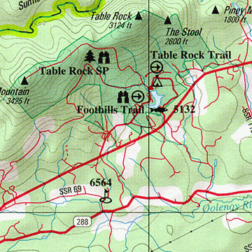
Some of the Map Symbols
| Campgrounds | |
| Attractions | |
| Trails | |
| Beaches | |
| Hunting | |
| Freshwater Fishing | |
| Recreation Areas | |
| Historic Sites | |
| Heritage Preserves | |
| Wildlife Viewing | |
| Golf Courses | |
| Information Centers | |
The detailed maps in the DeLorme Atlas and Gazetteer show physical features, such as lakes, rivers, creeks, swamps, bays, islands, forests and mountains. The man-made features include: roads, highways, interstates, preserves, cities and towns. State-wide topographic information is shown by contour lines with intervals of 20 feet, 60 feet or 120 feet, depending on the terrain. The extra features and details in this shaded relief map collection will make your trip-planning easy!