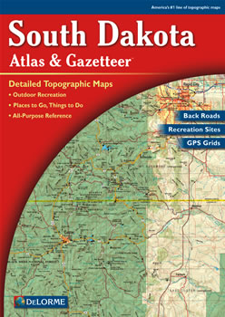
Makes a great gift |
 |
Large 11" x 15.5" Pages |
Topo Maps with Back Roads |
61 Pages of Maps |
11 Pages of Attractions, Information and Places to Visit |
Scale: 1:200,000 (1" = 3.2 miles) |
Only $19.99 |
| Ships right away by Priority Mail |
|
You can use this atlas to:
- Plan a scenic drive in Custer State Park
- Find museums and historic sites in Spearfish
- Explore the Black Hills National Forest
- Find camping sites near Rapid City
|
 |
A Sample Map From This Book
 |
 |
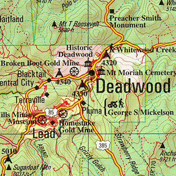
Some of the Map Symbols
 |
Attractions |
 |
Bicycle Routes |
 |
Campgrounds |
 |
Canoe Trips |
 |
Hiking |
 |
Fishing |
 |
State Lands |
 |
Historic Sites |
 |
Hunting - Game Production Areas |
 |
Scenic Drives |
 |
Tribal Lands |
 |
Unique Natural Features |
|
The DeLorme Atlas and Gazetteer is perfect for planning a vacation to South Dakota! This atlas has 61 large pages of shaded relief maps with an index of place names and map features. The back cover of this atlas has a large map of South Dakota with an overlying grid. Each cell of the grid contains the page number for a detailed map of that area. The physical and man-made features on these detailed maps include: lakes, sloughs, rivers, creeks, mountains, forests, reservations, grasslands, trails, roads, highways, interstates, cities, towns, parks, railroads and airports. State-wide topographic information is shown by contour lines with intervals of 120 feet.
This atlas also contains 11 pages of reference information for South Dakota’s public lands, tribal lands, hunting, fishing, unique natural features, attractions, historic sites, hiking trails, biking routes, canoe trips, scenic drives and campgrounds. This is not your ordinary map! The DeLorme Atlas and Gazetteer is a collection of topographic maps, a travel guide and activity planner all in one convenient book.
|
|
 |
|
View and print topographic maps for all 50 states and Canada!
|
 |
Iowa
|
 |
Montana
|
 |
North Dakota
|
 |
Wyoming
|

Atlas Cover only $4.95
 Canvas Zip Atlas Bag $12.95
|