 Makes a great gift!
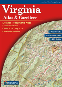
Virginia DeLorme Atlas
Complete Virginia Road Map and
Topographic Map Coverage
- Large 11" x 15.5" Pages
- Topo Maps with Back Roads
- 63 Pages of Maps
- 17 Pages of Attractions, Information and Places to Visit
- Scale: 1:150,000 (1" = 2.4 miles)
Here are some examples of how you can use this atlas:
- Find hiking trails in George Washington National Forest
- Explore museums and science centers in Richmond
- Review recreational options in Fairy Stone State Park
- Plan a vacation to Busch Gardens Williamsburg
|
Ships right away by Priority Mail
A Sample Map From This Book

Some of the Map Symbols
 |
Art Museums/Science Centers |
 |
Bicycle Routes |
 |
Campgrounds |
 |
Canoe Trips |
 |
Wineries |
 |
Fishing |
 |
Gardens |
 |
Waterfalls |
 |
Scenic Drives |
 |
Recreation Areas |
 |
Wildlife |
 |
Hiking |
This up-to-date atlas offers so much more than an ordinary map. The details and extras can help to plan your next vacation in Virginia!