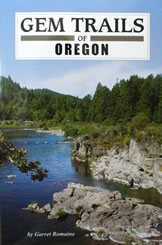
Gem Trails of Oregon
by Garret Romaine
Gem Trails of Oregon
|
|
| Introduction to this edition |
7
|
| How To Use This Guide |
8
|
| Oregon Geology |
14
|
| Map Legend |
17
|
| Key Sites to Locator Map |
18
|
| Oregon Site Map |
19
|
| Region I | |
| 1. Clackamette Park |
20
|
| 2. Memaloose |
22
|
| 3. Fish Creek |
24
|
| 4. Lake Harriet |
26
|
| 5. Cedar Butte |
28
|
| 6. Goble |
30
|
| 7. Ft. Stevens |
32
|
| 8. Short Beach |
36
|
| 9. Road's End |
38
|
| 10. Beverly Beach |
40
|
| 11. Lost Creek |
42
|
| 12. Big Creek |
44
|
| 13. Buster Creek |
46
|
| 14. Jewell Quarry |
48
|
| 15. Nehalem River |
50
|
| 16. Five Islands |
52
|
| 17. Independence |
54
|
| 18. Quartzville |
56
|
| 19. Ames Creek |
60
|
| 20. Stayton |
62
|
| 21. Thomas Creek |
64
|
| 22. Bohemia City |
66
|
| 23. Gold Hill |
68
|
| 24. Calapooia River |
72
|
| 25. Westfir |
74
|
| Region II | |
| 26. Eagle Rock |
76
|
| 27. Maury Mountain |
78
|
| 28. Paulina |
80
|
| 29. Bear Creek |
82
|
| 30. Hampton Butte |
84
|
| 31. Richardson's Ranch |
86
|
| 32. Priday Polka-Dot |
88
|
| 33. Ochoco Reservoir |
90
|
| 34. Lucky Strike |
92
|
| 35. Whistler Springs |
94
|
| Tools for Collecting |
96
|
| Color Specimen Insert |
97
|
| 36. White Fir |
106
|
| 37. White Rock |
108
|
| 38. Madras Pow-Wow |
110
|
| 39. The Dalles |
112
|
| 40. Biggs Junction |
114
|
| 41. Camp Carson |
116
|
| 42. Troy |
118
|
| 43. Enterprise |
120
|
| 44. Imnaha River |
122
|
| 45. Homestead |
126
|
| 46. Cornucopia |
128
|
| 47. Eagle Creek |
130
|
| 48. Fossil |
132
|
| 49. Arbuckle Mountain |
134
|
| 50. Coyote Peak |
136
|
| 51. Pocahontas Road |
138
|
| 52. Sumpter Dredge |
140
|
| 53. Greenhorn |
142
|
| 54. Susanville |
144
|
| 55. Shirttail Creek |
148
|
| 56. Lime |
150
|
| Region III | |
| 57. Glass Buttes |
152
|
| 58. Stinkingwater |
156
|
| 59. North Beede Reservoir |
158
|
| 60. Warm Springs |
160
|
| 61. Beulah Reservoir |
162
|
| 62. Twin Springs |
164
|
| 63. Succor Creek |
166
|
| 64. Graveyard Point |
170
|
| 65. Rockville |
174
|
| 66. Rome |
176
|
| 67. McDermitt |
178
|
| 68. Hines |
180
|
| 69. Delintment Lake |
182
|
| 70. Harney Lake |
184
|
| 71. Steens Mountains |
186
|
| 72. Pike Creek |
188
|
| 73. Whitehorse |
190
|
| 74. Pueblo Mountains |
192
|
| 75. Flook Lake |
194
|
| 76. Rabbit Hills |
196
|
| 77. Crane Creek |
200
|
| 78. Drews Reservoir |
202
|
| 79. Dry Creek |
204
|
| 80. Juniper Ridge |
206
|
| Region IV | |
| 81. Whisky Run |
208
|
| 82. Orchard Bar |
210
|
| 83. Agness |
212
|
| 84. Pistol River |
214
|
| 85. Social Security Bar |
216
|
| 86. Emigrant Lake |
218
|
| 87. Agate Desert |
220
|
| 88. Applegate |
222
|
| 89. Elliot Creek Ridge |
226
|
| 90. Illinois River |
228
|
| 91. Josephine Creek |
230
|
| 92. Althouse Creek |
232
|
| 93. Gold Nugget |
234
|
| 94. Powell Creek |
236
|
| 95. Zinc Creek |
238
|
| 96. Idleyld |
240
|
| 97. Little River |
242
|
| 98. South Fork of the Umpqua |
244
|
| 99. Myrtle Creek |
246
|
| 100. Riddle |
248
|
| Appendix A: Oregon Web Links |
250
|
| Appendix B: Natural History and Mining Museums |
252
|
| Appendix C: Rock and Mineral Clubs, Societies and Organizations |
254
|
| Appendix D: Rockhounding Rules and Regulations |
256
|
| Appendix E: Oregon Vistas and Viewpoints |
259
|
| Glossary |
260
|
| Bibliography |
267
|
| Mineral Locator Index |
268
|
ADVERTISEMENT
