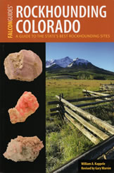
Rockhounding Colorado
by William A. Kappele
Rockhounding Colorado
|
|
| Acknowledgments |
x
|
| Map Legend |
xii
|
| About This Book |
xiii
|
| Introduction |
1
|
| Finding Your Way |
4
|
| Safety Tips |
5
|
| Rockhound Etiquette |
8
|
| Sights Along the Way |
11
|
| Northwestern Colorado | |
| 1. Wolf Creek Agate |
22
|
| 2. Calico Draw |
25
|
| 3. Cross Mountain |
27
|
| 4. Douglas Mountain |
29
|
| 5. Troublesome Creek |
31
|
| 6. Green Mountain Reservoir |
33
|
| 7. Rock Candy Mountain |
35
|
| 8. Douglas Pass |
37
|
| 9. Rangely |
39
|
| 10. Parachute |
41
|
| 11. Gypsum |
44
|
| 12. Dotsero |
46
|
| 13. Wolcott |
48
|
| 14. Delaney Butte |
50
|
| 15. Rabbit Valley |
52
|
| Northeastern Colorado | |
| 16. Genessee Dike |
55
|
| 17. Boulder |
57
|
| 18. Golden Gate Canyon |
59
|
| 19. Sugarloaf Road |
61
|
| 20. Jamestown |
63
|
| 21. Crystal Mountain |
65
|
| 22. Owl Canyon |
67
|
| Southwestern Colorado | |
| 23. Opal Hill |
70
|
| 24. Pinon Mesa |
72
|
| 25. Whitewater |
75
|
| 26. Copper Creek |
77
|
| 27. Gateway |
79
|
| 28. Ouray Mines |
81
|
| 29. Senorita Mine |
84
|
| 30. Bullion King Mine |
86
|
| 31. US Basin |
89
|
| 32. Silverton Mines |
91
|
| 33. Aspen Mine |
93
|
| 34. Eureka Gulch |
96
|
| 35. Placer Gulch |
99
|
| 36. La Plata Canyon |
102
|
| 37. Rico Mines |
105
|
| Southeastern Colorado | |
| 38. Meyers Ranch Roadcut |
108
|
| 39. Garo |
110
|
| 40. Wilkerson Pass |
112
|
| 41. Topaz Mountain Gem Mine |
114
|
| 42. Lake George |
117
|
| 43. Round Mountain Campground |
119
|
| 44. Highway 24 Roadcuts |
121
|
| 45. Florissant Fossil Beds National Monument |
123
|
| 46. Florissant Fossil Quarry |
126
|
| 47. Opportunity Mine |
128
|
| 48. Cochetopa Dome |
130
|
| 49. Crystal Hill |
132
|
| 50. Houselog Creek |
135
|
| 51. Creede |
137
|
| 52. Last Chance Mine |
140
|
| 53. Twin Mountains |
142
|
| 54. Ruby Mountain |
145
|
| 55. Mount Antero |
147
|
| 56. Clara May Mine |
150
|
| 57. Midway Spring |
152
|
| 58. Rock King Mine |
154
|
| 59. Homestake Mine |
156
|
| 60. Calumet Mine |
158
|
| 61. Salida Marble |
160
|
| 62. Turret |
162
|
| 63. Browns Canyon |
164
|
| 64. Marshall Pass |
166
|
| 65. Leadville Mines |
169
|
| 66. Lake City Mines |
171
|
| 67. Bonanza |
174
|
| 68. Swissvale |
176
|
| 69. Texas Creek |
178
|
| 70. Lone Pine Recreation Site |
180
|
| 71. Silver Cliff |
182
|
| 72. Border Feldspar Mine |
184
|
| 73. Royal Gorge Road |
186
|
| 74. Canon City |
188
|
| 75. Burnt Mill Road Exit |
191
|
| 76. Highway 96 (A) |
193
|
| 77. Highway 96 (B) |
196
|
| 78. Tepee Buttes |
198
|
| 79. Penrose |
200
|
| 80. Russell |
202
|
| 81. St. Peter's Dome |
204
|
| 82. Devils Head |
207
|
| 83. Perry Park |
209
|
| Fifteen Trips for the Intrepid Explorer |
211
|
| Appendix A: Glossary |
219
|
| Appendix B: Map Sources |
223
|
| Appendix C: Bureau of Land Management Contact Information |
225
|
| Appendix D: County Office Contact Information |
228
|
| Appendix E: National Forest Contact Information |
232
|
| Index |
234
|
| About the Authors |
236
|
ADVERTISEMENT
