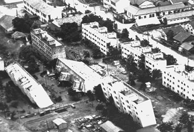
Liquefaction in Japan: Tilted apartment buildings at Kawagishi cho, Niigata, Japan; the soils beneath these buildings liquefied during an earthquake in 1964 and provided little support for the building foundations. These tilted buildings and liquefaction in this area are probably the most well known examples of liquefaction and loss of bearing strength. Image and caption by USGS.
Definition of Liquefaction
Liquefaction occurs when vibrations or water pressure within a mass of soil cause the soil particles to lose contact with one another. As a result, the soil behaves like a liquid, has an inability to support weight and can flow down very gentle slopes. This condition is usually temporary and is most often caused by an earthquake vibrating water-saturated fill or unconsolidated soil.
Conditions that Cause Liquefaction
Liquefaction most often occurs when three conditions are met:
- loose, granular sediment or fill
- saturation by groundwater
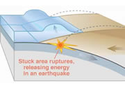
- strong shaking
California liquefaction map: A portion of a liquefaction susceptibility map of an area near Oakland, California produced by the United States Geological Survey. The map is color-coded to show areas of very high (red), high (orange), moderate (yellow), low (green) and very low (white) susceptibility to liquefaction. This type of map is valuable in making land-use and development decisions. Image by USGS.
Liquefaction Susceptibility Mapping
An understanding of the conditions that cause liquefaction enables geologists to produce maps of liquefaction susceptibility. This has been done for the San Francisco Bay area and other locations where earthquakes might trigger liquefaction. A sample from one of these maps is shown on this page.
Video: Soil liquefaction: Dr. Ellen Rathje uses a model to demonstrate and explain soil liquefaction.
Video: What is liquefaction? Much of the damage experienced in New Zealand during the 2011 Christchurch earthquake was caused by liquefaction.
| More Earthquakes |
 |
Largest Earthquake |
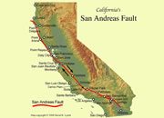 |
What is the San Andreas Fault? |
 |
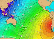
What Causes a Tsunami? |
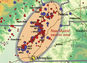 |
New Madrid Seismic Zone |
 |
The Japan Earthquake |
 |
Gifts That Rock |
 |
Teaching Plate Tectonics |
 |
Small Earthquakes |

Find Other Topics on Geology.com:

|

| ||

|

| ||

|

| ||

|

|