Makes a great gift!
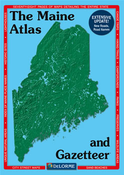
Maine DeLorme Atlas
Complete Maine Road Map and
Topographic Map Coverage
- Topo Maps with Back Roads
- 78 Pages of Maps
- 18 Pages of Attractions, Information and Places to Visit
- Scale: 1:125,000 (1" = 2 miles)
This great atlas can help you to:
|
A Sample Map From This Book
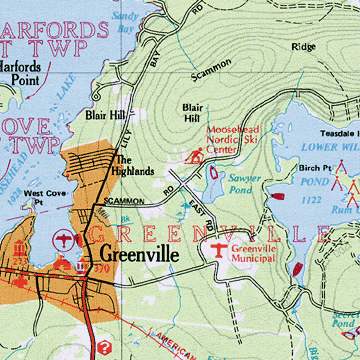
Some of the Map Symbols
| Hiking Trails | |
| Downhill Skiing | |
| Campgrounds | |
| Lighthouses | |
| Unique Natural Areas | |
| Scenic Waterfalls | |
| Parks and Recreation Areas | |
| Sand Beaches | |
| Museums and Historic Sites | |
| Canoe Trips & Whitewater Rafting | |
| Wildlife Management Areas | |
| Nature Preserves | |
There are 18 additional pages of reference information giving attention to Maine's many attractions and activities! The areas of interest include: Maine's sand beaches, natural preserves, fishing, wildlife viewing, parks, recreation areas, hiking trails, unique natural areas, scenic waterfalls, canoe trips, skiing, historic lighthouses, campgrounds, airports, airfields, historic forts and museums. There is also a mileage chart, numerous city street maps, and a chart giving the population and location of Maine's Minor Civil Divisions. This DeLorme Atlas and Gazetteer is a convenient topographic map collection, recreation guide and travel planner available in one book!