Makes a great gift!
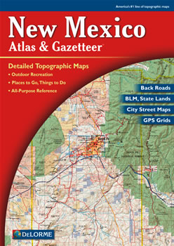
New Mexico DeLorme Atlas
Complete New Mexico Road Map and
Topographic Map Coverage
- Topo Maps with Back Roads
- 61 Pages of Maps
- 11 Pages of Attractions, Information and Places to Visit
- Scale: 1:300,000 (1" = 4.7 miles)
A few ways you can use this atlas:
|
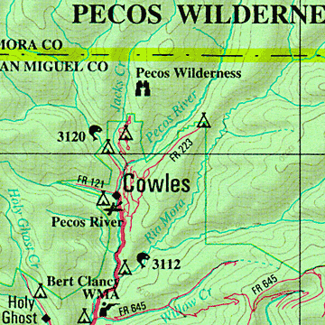
A Sample Map From This Book
Some of the Map Symbols
| Attractions/Museums | |
| Whitewater Recreation | |
| Campgrounds | |
| Fishing | |
| Hunting | |
| Trails | |
| Recreation Areas | |
| Scenic Drives | |
| Historic Sites | |
| Downhill Ski Areas | |
| Unique Natural Features | |
| Wildlife Viewing | |
The back cover of this atlas has a large map of New Mexico with an overlying grid. Each cell of the grid contains the page number for a detailed map of that area. In addition, there is an index of the state's place names and map features for easy look-up. The detailed maps show numerous physical and man-made features. These features include: forests, mountains, plains, canyons, rivers, lakes, creeks, place names, airports, railroads, roads, highways, interstates, reservations, conservation areas and parks. The state-wide topographic information is shown by contour lines with intervals of 300 feet. You will be impressed with the details and extras this atlas has to offer!