Makes a great gift!
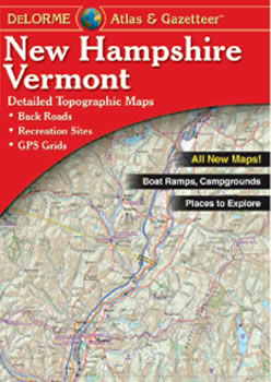
Vermont and New Hampshire DeLorme Atlas
Complete Vermont and New Hampshire Road Map
and Topographic Map Coverage
- Topo Maps with Back Roads
- 103 Pages of Maps
- 17 Pages of Attractions, Information and Places to Visit
- Scale: 1:100,000 (1" = 1.6 miles)
Some suggested ways to use this atlas are to:
|
A Sample Map From This Book
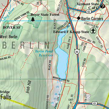
Some of the Map Symbols
| Attractions | |
| Bicycle Routes | |
| Campgrounds | |
| Covered Bridges | |
| Downhill Skiing | |
| Fishing | |
| Gardens | |
| Golf Courses | |
| Scenic Drives | |
| State Lands | |
| Wildlife Viewing | |
| Hiking | |
There are 17 pages of reference information for Vermont's numerous points of interest and recreation. Some examples of the information you will find are: the state's covered bridges, maple sugarhouses, gardens, unique natural features, scenic drives, historic sites, campgrounds, skiing, hiking, fishing, public lands and golf courses. Also included are street maps for over 50 Vermont towns and cities. The extra features and details in this up-to-date map collection will make your trip-planning easy!