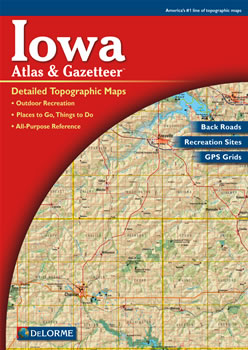
Home » Store » Delorme Atlas » Iowa

Iowa DeLorme Atlas
Makes a great gift!

Iowa DeLorme Atlas

Complete Iowa Road Map and
Topographic Map Coverage

Only $24.99
- Large 11" x 15.5" Pages
- Topo Maps with Back Roads
- 51 Pages of Maps
- 13 Pages of Attractions, Information and Places to Visit
- Scale: 1:200,000 (1" = 3.2 miles)

A few ways you might use this atlas would be to:
  • Locate one of Iowa's numerous rail-trail bike trails!
  • Find camping near Garnavillo
  • Learn what types of fish are caught in Spirit Lake
  • Find kid-friendly attractions while in Des Moines
Ships right away by Priority Mail

  A Sample Map From This Book

sample map

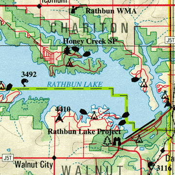
Some of the Map Symbols

Iowa attractions Attractions
Iowa biking Biking
Iowa campgrounds Campgrounds
Iowa fishing Fishing
Iowa canoe trips Canoe Trips
Iowa scenic drives Scenic Drives
Iowa state lands State Lands
Iowa wildlife Wildlife Viewing
Iowa history Historic Sites
Iowa covered bridges Covered Bridges
Iowa hiking Hiking
Iowa hunting Hunting
Get the state of Iowa in 51 large pages of up-to-date, shaded relief maps in the DeLorme Atlas and Gazetteer! The maps show state-wide topographic information using contour lines with intervals of 120 feet. The atlas has an index of place names and map features. The back cover of this atlas has a large map of Iowa with an overlying grid. Each cell of the grid contains the page number for a detailed map of that area. Many physical and man-made features are detailed on each map. These include: creeks, rivers, lakes, springs, ridges, forests, railroads, airports, reservoirs, dams, parks, roads, trails, highways and interstates.

An additional 13 pages of reference information is included in this atlas. These detail attractions such as state lands, covered bridges, state preserves, biking, wildlife viewing, historic sites, canoe trips, fishing, hunting, camping, hiking and scenic drives. There are so many extras that you will be impressed with the DeLorme Atlas and Gazetteer!