Makes a great gift!
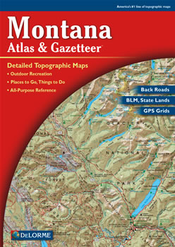
Montana DeLorme Atlas
Complete Montana Road Map and
Topographic Map Coverage
- Topo Maps with Back Roads
- 80 Pages of Maps
- 16 Pages of Attractions, Information and Places to Visit
- Scale: 1:250,000 (1" = 4 miles)
A few ways you might use this atlas:
|
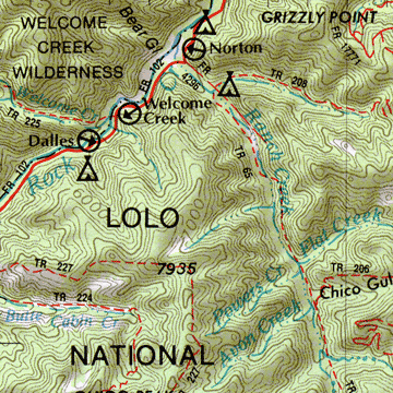
A Sample Map From This Book
Some of the Map Symbols
| BLM Public Lands | |
| Ski Areas | |
| Campgrounds | |
| Fishing | |
| Wildlife Viewing | |
| Hiking | |
| State Lands | |
| Scenic Drives | |
| Historic Sites/Museums | |
| Hunting | |
| National Lands | |
| Unique Natural Features | |
The atlas has an index of the state's place names and map features. The back cover of this atlas has a large map of Montana with an overlying grid. Each cell of the grid contains the page number for a detailed map of that area. The physical features shown on these maps include mountains, forests, rivers, lakes, creeks and springs. In addition there are man-made features which include: place names, airports, railroads, reservoirs, roads, highways and interstates, reservations, wildlife refuge areas and parks. The state-wide topographic information is shown by contour lines with intervals of 100 or 200 feet, depending on the terrain. You will be impressed with the details and extras this atlas has to offer!