Home » Store » Delorme Atlas » Idaho

Idaho DeLorme Atlas
Makes a great gift!

Idaho DeLorme Atlas

Complete Idaho Road Map and
Topographic Map Coverage

Only $24.99
- Large 11" x 15.5" Pages
- Topo Maps with Back Roads
- 48 Pages of Maps
- 16 Pages of Attractions, Information and Places to Visit
- Scale: 1:250,000 (1" = 4 miles)

A few ways you can use this atlas:
  • Map your hike on the Lewis and Clark Trail
  • Explore historic sites in Pocatello
  • Find RV camping sites near Coeur d'Alene
  • Review scenic routes in Craters of the Moon National Monument
Ships right away by Priority Mail

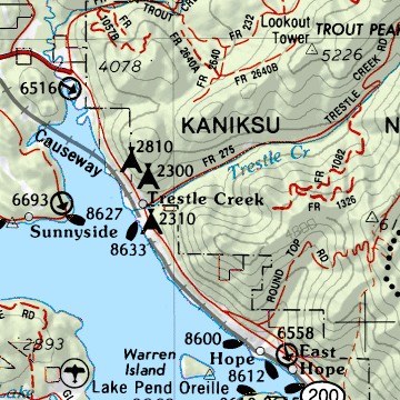
  A Sample Map From This Book

sample map

Some of the Map Symbols

Idaho BLM lands BLM Public Lands
Idaho campgrounds Campgrounds
Idaho river trips River Trips
Idaho fishing Fishing
Idaho hiking Hiking
Idaho scenic drives Scenic Drives
Idaho forests, recreation National Forests/Recreation Areas
Idaho ski areas Ski Areas
Idaho history and museums Historic Sites/Museums
Idaho sportsman access Sportsman's Access Areas
Idaho natural features Unique Natural Features
Idaho hunting Hunting - Fish and Game Offices
Get 48 pages of up-to-date maps for the state of Idaho in one handy guide - the DeLorme Atlas and Gazetteer! Find the right map fast with a convenient place-name index. The back cover of this atlas has a large map of Idaho with an overlying grid. Each cell of the grid contains the page number for a detailed map of that area. The detailed maps show physical and man-made features, such as lakes, rivers, springs, reservoirs, creeks, valleys, forests, ranges, mountains, towns, reservations, cities, airports, highways, interstates, roads, trails, parks, and areas of lava flow. State-wide topographic information is shown by contour lines with intervals of 400 feet.

This atlas has 16 additional pages of reference information on the state's activities. The recreation and points of interest include: national forests, state parks, hiking, unique natural features, BLM public lands, historic sites, museums, hunting, sportsman's access areas, campgrounds, boat ramps, fishing, river trips, ski areas, and scenic drives. There is also a two-page map that shows public owned lands in Idaho. With the extras and details this atlas has to offer, you can easily plan your next vacation to Idaho!