 Makes a great gift!
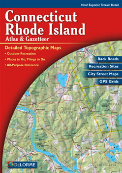
Rhode Island DeLorme Atlas
Complete Rhode Island Road Map and
Topographic Map Coverage
- Large 11" x 15.5" Pages
- Topo Maps with Back Roads
- 60 Pages of Maps
- 20 Pages of Attractions, Information and Places to Visit
- Scale: 1:65,000 (1" = 1 mile)
Some suggested ways to use this atlas are to:
- Find mansion tours in Newport, Rhode Island
- Learn recreational activities available at Colt State Park
- Find kid-friendly activities in Weekapaug
- Map a paddling trip on Olney Pond
|
Ships right away by Priority Mail
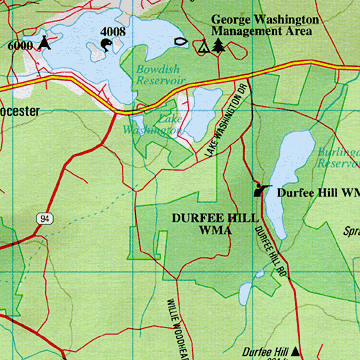
A Sample Map From This Book
Some of the Map Symbols
 |
Paddling |
 |
Ski Areas |
 |
Hunting |
 |
Attractions |
 |
Campgrounds |
 |
Recreation Areas |
 |
Fishing |
 |
Scenic Drives |
 |
Golf Courses |
 |
Trails |
 |
Historic Sites |
 |
Unique Natural Features |
Rhode Island and Connecticut's place names and map features are indexed for easy look-up. The back cover of this atlas has a large map of Rhode Island and Connecticut with an overlying grid. Each cell of the grid contains the page number for a detailed map of that area. The details available with the DeLorme Atlas and Gazetteer can help plan your next vacation to Rhode Island!