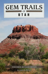
Gem Trails of Utah
by James R. Mitchell
Gem Trails of Utah
|
|
| Introduction |
6
|
| Utah Geology |
7
|
| Mining History |
7
|
| Mining Districts |
8
|
| Rockhounding Rules and Regulations |
10
|
| Hints for Collecting Minerals |
14
|
| Hints for Collecting Gem Materials |
15
|
| Government Agencies List |
16
|
| Rock and Mineral Societies |
17
|
| Natural History and Mining Museums |
18
|
| Map Legend |
19
|
| Key Sites to Locator Map |
20
|
| Utah Site Map |
21
|
| Region I | |
| 1. Mantua |
22
|
| 2. Dove Creek Mountains |
24
|
| 3. Hyrum |
26
|
| 4. Great Salt Lake |
28
|
| 5. Knolls |
30
|
| 6. Delta Trilobite Quarry |
32
|
| 7. Swasey Mountain - West |
34
|
| 8. Swasey Mountain - East |
36
|
| 9. Sawtooth Mountain |
38
|
| 10. Conger Mountain |
40
|
| 11. Silver Island Mountains |
42
|
| 12. Painter Spring |
44
|
| 13. Little Valley |
46
|
| 14. Gold Hill |
48
|
| 15. Tule Valley |
50
|
| 16. Eureka |
52
|
| 17. Silver City |
54
|
| 18. Yuba Lake |
56
|
| 19. Levan |
58
|
| 20. Ophir and Mercur |
60
|
| 21. Nephi |
62
|
| 22. Topaz Mountain |
64
|
| 23. Thomas Range |
66
|
| 24. Ponderosa Campground |
68
|
| 25. Dugway |
70
|
| 26. Vernon |
72
|
| Region II | |
| 27. Vernal |
74
|
| 28. Woodruff |
76
|
| 29. Coalville |
78
|
| Tumble Polishing Rocks |
80
|
| Color Specimen Insert |
81
|
| 30. Woodland |
90
|
| 31. Alta |
92
|
| 32. Emigration Canyon |
94
|
| 33. Silver Creek Junction |
96
|
| 34. Helper |
98
|
| 35. Fairview |
100
|
| Region III | |
| 36. Long Valley Junction |
102
|
| 37. Little Creek Mountain |
104
|
| 38. Red Butte |
106
|
| 39. Summit |
108
|
| 40. Cedar Canyon |
110
|
| 41. Parowan |
112
|
| 42. Virgin |
114
|
| 43. Brian Head |
116
|
| 44. Agate Hill |
118
|
| 45. Panguitch |
120
|
| 46. Marysvale |
122
|
| 47. Beaver |
124
|
| 48. Clear Lake |
126
|
| 49. Mt. Carmel |
128
|
| 50. Sawtooth Peak |
130
|
| 51. Wah Wah Mountains |
132
|
| 52. Old Frisco |
134
|
| 53. West of Milford |
136
|
| 54. Black Rock |
138
|
| 55. Milford Area |
140
|
| 56. Corral Canyon |
142
|
| 57. North of Milford |
144
|
| 58. Salina Canyon |
146
|
| Region IV | |
| 59. Torrey |
148
|
| 60. Notom |
150
|
| 61. Caineville |
152
|
| 62. Factory Butte |
154
|
| 63. Willow Springs Wash |
156
|
| 64. Blue Flats |
158
|
| 65. Fremont River |
160
|
| 66. West of Hanksville |
162
|
| 67. Hanksville |
164
|
| 68. Hell's Backbone |
166
|
| 69. Clay Hills |
168
|
| 70. Moss Back |
170
|
| 71. Little Egypt |
172
|
| 72. Green River |
174
|
| 73. Crescent Junction #1 |
176
|
| 74. Crescent Junction #2 |
178
|
| 75. Looking Glass Road |
180
|
| 76. La Sal Junction |
182
|
| 77. Moab |
184
|
| 78. Lockhart Basin |
186
|
| 79. Courthouse Pasture |
188
|
| 80. Potash Road |
190
|
| 81. Dubinky Well |
192
|
| 82. Sevenmile Canyon |
194
|
| 83. Dewey |
196
|
| 84. Owl Draw |
198
|
| 85. Cisco and Yellow Cat |
200
|
| 86. San Rafael |
202
|
| 87. San Rafael Reef |
204
|
| 88. Shadescale Mesa |
206
|
| 89. Summerville Wash |
208
|
| 90. Buckmaster |
210
|
| 91. Castle Dale |
212
|
| 92. Book Cliffs |
214
|
| Other Utah Attractions |
216
|
| Mineral Locator Index |
217
|
| Glossary |
222
|
| Other Titles Available |
229
|
| Notes |
230
|
ADVERTISEMENT
