United States Wall Maps for Sale !
Wall maps of the United States for schools, homes and offices.
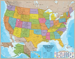
Blue Ocean USA Wall Map
The Blue Ocean Laminated Wall Map of the United States is our best value in a United States wall map. Vibrant colors, highly informative, laminated for durability, and an attractive price. It measures 38 inches tall by 48 inches wide. We are able to sell it at a reasonable price because it is published in very large numbers. These maps are popular with students and help them learn United States geography. Companies use them in conference rooms and offices to summarize their activities with push-pins, flags, photos and notes. Your map will ship no later than the next business day, rolled in a tube, by Priority Mail through the United States Postal Service.
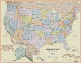
Boardroom USA Wall Map
The Boardroom map style is popular for offices and conference rooms. It has a subdued background and state color-scheme. This allows you to use brightly colored push-pins, markers, and flagging to annotate the map with the geography of your company or travels and see them clearly. Laminated so you can mark on it with dry erase markers and wipe the map clean when finished.
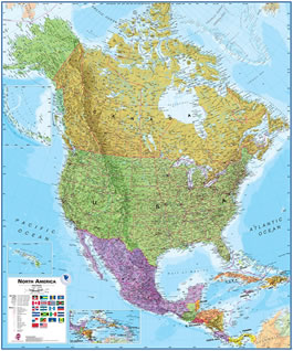
North America Wall Map
Need a map that goes beyond the United States? This North America wall map includes Canada, portions of the Arctic and North Atlantic, Mexico, Central America and the Caribbean Islands. It features state and province boundaries and capital cities for the United States and Canada. Major highways are shown and major mountain ranges are depicted in shaded relief. The perfect map for students, companies or individuals with an interest in North America.