Alaska Map Collection

Alaska Borough Map:
This map shows Alaska's 16 boroughs and 11 census areas. Also available is a detailed Alaska Borough Map with borough seat cities.
ADVERTISEMENT


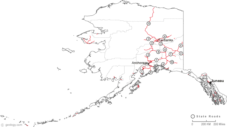
Map of Alaska Cities:
This map shows many of Alaska's important cities and most important roads. Important north - south routes include: State Road 3, State Road 4, State Road 7, State Road 9 and State Road 11. Important east - west routes include: State Road 1, State Road 2, State Road 5, State Road 6, State Road 8 and State Road 10. We also have a more detailed Map of Alaska Cities.
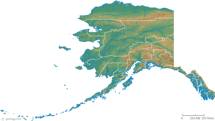
Alaska Physical Map:
This Alaska shaded relief map shows the major physical features of the state. For other nice views of the state, see our Alaska Satellite image or the Alaska map by Google.
ADVERTISEMENT
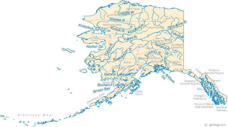
Alaska Rivers Map:
This map shows the major streams and rivers of Alaska and some of the larger lakes. Most of Alaska drains into the Bering Sea through the Noatak, Kebuk, Yukon and Kuskokwim Rivers. The southern portions of the state and south sides of the Aleutian Islands drain into the GUlf of Alaska. The northernmost part of Alaska drains into the Arctic Ocean. Most of these lakes and streams can be clearly seen on the Alaska Satellite Image. We also have a page about Alaska water resources.
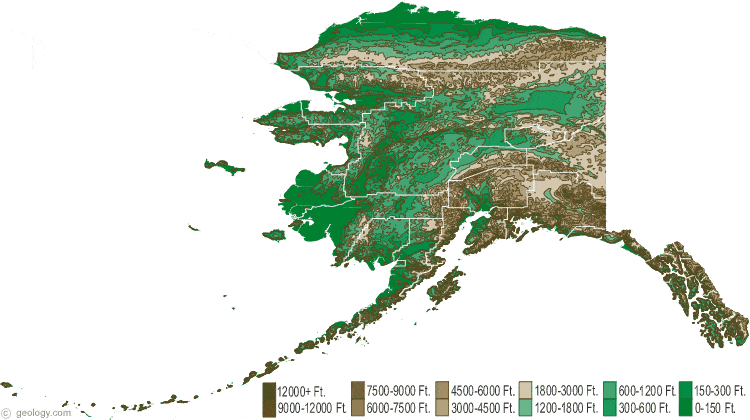
Alaska Elevation Map:
This is a generalized topographic map of Alaska. It shows elevation trends across the state. Detailed topographic maps and aerial photos of Alaska are available in the Geology.com store. See our state high points map to learn about Mt. McKinley at 20,237 feet - the highest point in Alaska. The lowest point is the Pacific Ocean at Sea Level.