Hawaii Map Collection

High-Resolution Topo Maps of Maui |
Hawaii County Map:
This map shows Hawaii's 5 counties. Also available is a detailed Hawaii County Map with county seat cities.
Counties of Hawaii:
Hawaii County includes the Island of Hawaii, also called the "Big Island."
Maui County includes the islands of Maui, Molokai (except the Kalaupapa Peninsula), Lanai, Kahoolawe, and Molokini.
Kalawao County is located on the Kalaupapa Peninsula of Molokai Island.
Honolulu County includes the island of Oahu and also the Northwestern Hawaiian Islands (except Midway Atoll, which is considered a U.S. Territory and is not part of the state of Hawaii). The Northwestern Hawaiian Islands (sometimes called the Leeward Islands) are several small islands and atolls which lie northwest of Kauai County.
Kauai County includes the islands of Kauai, Niihau, Lehua, and Kaula.
ADVERTISEMENT


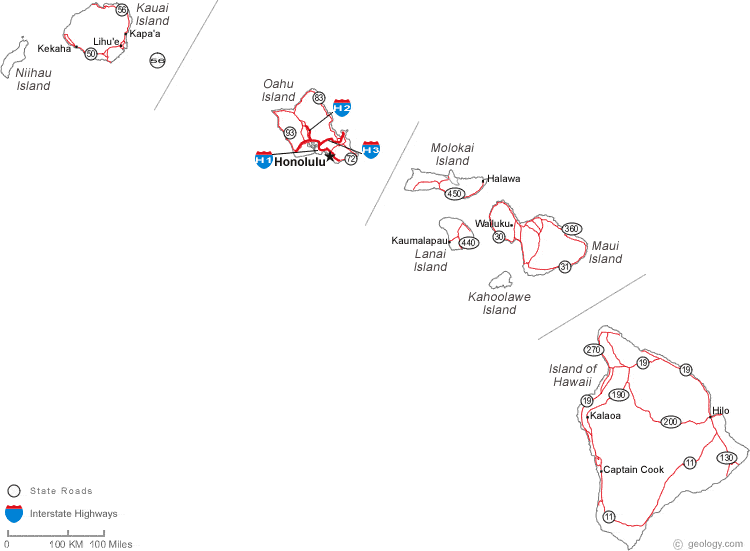
Map of Hawaii Cities:
This map shows many of Hawaii's important cities and most important roads. Important routes include: Interstate H1, Interstate H2 and Interstate H3. We also have a more detailed Map of Hawaii Cities.

Hawaii Physical Map:
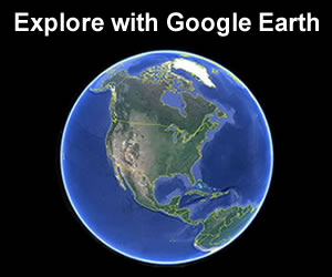
This Hawaii shaded relief map shows the major physical features of the state. For other nice views of the state, see our Hawaii Satellite image or the Hawaii map by Google.
ADVERTISEMENT
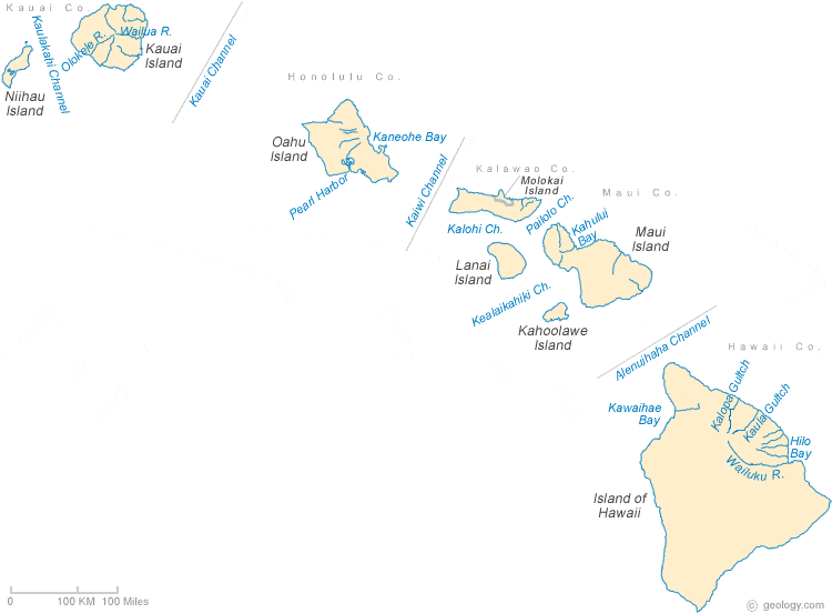
Hawaii Rivers Map:
This map shows the major streams and rivers of Hawaii. These volcanic islands have radial drainage and are not large enough for streams of significant size to develop. Most of these lakes and streams can be clearly seen on the Hawaii Satellite Image. We also have a page about Hawaii water resources.
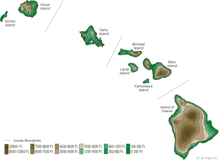
Hawaii Elevation Map:
This is a generalized topographic map of Hawaii. It shows elevation trends across the state. Detailed topographic maps and aerial photos of Hawaii are available in the Geology.com store. See our state high points map to learn about Pu'u Wekiu, Mauna Kea at 13,796 feet - the highest point in Hawaii. The lowest point is the Pacific Ocean at Sea Level.