Home » US Maps » Oklahoma Maps
Oklahoma Map Collection

Oklahoma County Map:
This map shows Oklahoma's 77 counties. Also available is a detailed Oklahoma County Map with county seat cities.
ADVERTISEMENT


Map of Oklahoma Cities:
This map shows many of Oklahoma's important cities and most important roads. The important north - south route is Interstate 35. Important east - west routes include: Interstate 40 and Interstate 44. We also have a more detailed Map of Oklahoma Cities.
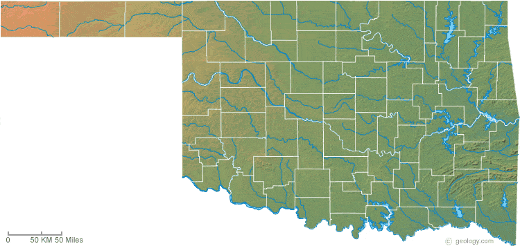
Oklahoma Physical Map:
This Oklahoma shaded relief map shows the major physical features of the state. For other nice views of the state, see our Oklahoma Satellite image or the Oklahoma map by Google.
ADVERTISEMENT
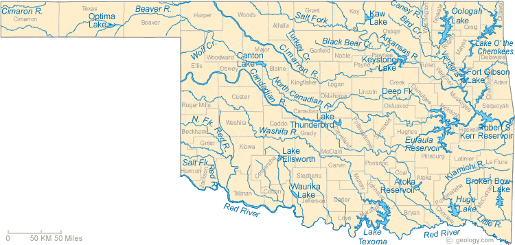
Oklahoma Rivers Map:
This map shows the major streams and rivers of Oklahoma and some of the larger lakes. Oklahoma is in the Gulf of America Watershed. Most of Oklahoma's topography is a plain sloping towards the east and the drainage follows this pattern. Most water leaves the state through the Red, Washita, Canadian, Cimaron and Arkansas Rivers. Most of these lakes and streams can be clearly seen on the Oklahoma Satellite Image. We also have a page about Oklahoma water resources.
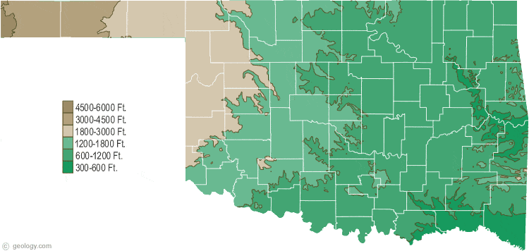
Oklahoma Elevation Map:
This is a generalized topographic map of Oklahoma. It shows elevation trends across the state. Detailed topographic maps and aerial photos of Oklahoma are available in the Geology.com store. See our state high points map to learn about Black Mesa at 4,973 feet - the highest point in Oklahoma. The lowest point is Little River at 289 feet.