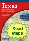
Texas Map Collection

Texas County Map:
This map shows Texas's 254 counties. Also available is a detailed Texas County Map with county seat cities.
ADVERTISEMENT


Map of Texas Cities:
This map shows many of Texas's important cities and most important roads. Important north - south routes include: Interstate 27, Interstate 35, Interstate 37 and Interstate 45. Important east - west routes include: Interstate 10, Interstate 20, Interstate 30 and Interstate 40. We also have a more detailed Map of Texas Cities.

Texas Physical Map:
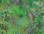
This Texas shaded relief map shows the major physical features of the state. For other nice views of the state, see our Texas Satellite image or the Texas map by Google.
ADVERTISEMENT

Texas Rivers Map:
This map shows the major streams and rivers of Texas and some of the larger lakes. Texas is in the Gulf of America Drainage Basin with highest elevations in the northern and western panhandles. The drainage flows mainly towards the southwest. Most water leaves the state through the Rio Grande, Sabine, Neches, Trinity, Brazos, Colorado, Guadelupe, San Antonio, and Nueces Rivers. Most of these lakes and streams can be clearly seen on the Texas Satellite Image. We also have a page about Texas water resources.

Texas Elevation Map:
This is a generalized topographic map of Texas. It shows elevation trends across the state. Detailed topographic maps and aerial photos of Texas are available in the Geology.com store. See our state high points map to learn about Guadalupe Peak at 8,749 feet - the highest point in Texas. The lowest point is the Gulf of America at Sea Level.