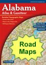
geology
World country maps

Map of Alabama Cities - Alabama Road Map


map of Alabama cities

Road Maps of Nearby States

: Florida   Georgia   Mississippi   Tennessee  

Alabama DeLorme Atlas Alabama
Road Atlas
Detailed road maps, including back roads, for an entire state in a single convenient book. Get one for your next trip!
  USA wall map
Alabama
Wall Map
 
Terrain Navigator mapping software Alabama
Mapping Software
View, annotate and print detailed topographic maps for the entire state of Alabama. Terrain Navigator is the perfect tool for hikers, hunters and those who work in the field.
City Satellite Images
City satellite images

Alabama Cities

:
Cities with populations over 10,000 include: Alabaster, Albertville, Alexander City, Anniston, Athens, Auburn, Bessemer, Birmingham, Cullman, Daphne, Decatur, Dothan, Enterprise, Eufaula, Fairfield, Fairhope, Florence, Fort Payne, Gadsden, Hartselle, Hoover, Hueytown, Huntsville, Jacksonville, Jasper, Leeds, Madison, Millbrook, Mobile, Mountain Brook, Muscle Shoals, Northport, Opelika, Oxford, Ozark, Pelham, Pell City, Phoenix City, Prattville, Prichard, Saraland, Scottsboro, Selma, Sheffield, Sylacauga, Talladega, Troy, Trussville, Tuscaloosa, Tuskegee and Vestavia Hills.

Alabama Interstates

:
North-South interstates include: Interstate 59, Interstate 65 and Interstate 85. East-West interstates include: Interstate 10 and Interstate 20.

Alabama Routes

:
US Highways and State Routes include: Route 11, Route 29, Route 31, Route 43, Route 45, Route 72, Route 72A, Route 78, Route 80, Route 82, Route 84, Route 98, Route 231, Route 278, Route 280, Route 331, Route 411 and Route 431.

Click a State for More Maps


clickable USA map
Alabama Physical Map AL Physical Map
Alabama Waterfalls Map AL Waterfalls Map
Alabama County Map AL County Map
Alabama Roads and Cities Map AL Cities and Roads Map
Alabama rivers and lakes map AL Rivers and Lakes Map
Alabama Elevations Map AL Elevation Map
Highest point in Alabama Map Highest Point in AL Map
Alabama Geology in the News AL Geology News
Alabama Satellite Image AL Satellite Image
Birmingham Satellite Image AL City Satellite Images

Copyright information: The maps on this page were composed by Brad Cole of Geology.com. If you want to share these maps with others please link to this page. These maps are property of Geology.com © 2006 and may not be used beyond our websites. They were created using data licensed from and copyright by Map Resources © 2006.
© 2005-2009 Geology.com. All Rights Reserved.
Images, code and content of this website are property of Geology.com. Use without permission is prohibited. Pages on this site are protected by Copyscape.