Home » US Maps » Hawaii » Roads and Cities
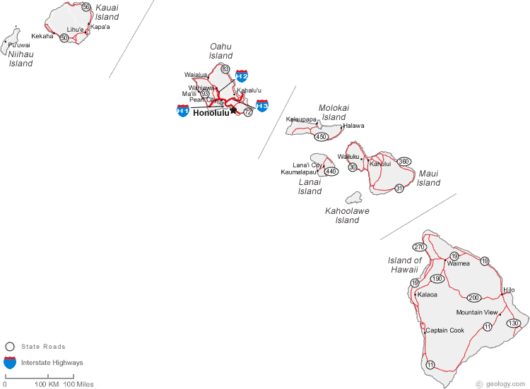
Map of Hawaii Cities and Roads
High-Resolution Topo Maps of Maui |
ADVERTISEMENT


Hawaii Cities:
Cities include: Captain Cook, Halawa, Hilo, Honolulu, Kahului, Kalaoa, Kalaupapa, Kamalo, Kapaa, Kaumalapau, Kekaha, Lanai City, Lihue, Maili, Mountain View, Pearl City, Puuwai, Wahiawa, Waialua, Wailuku, Waimanalo and Waimea.
Hawaii Interstates:
Interstates include: H1, H2 and H3.
Hawaii Routes:
State roads include: State Road 11, State Road 19, State Road 30, State Road 31, State Road 50, State Road 56, State Road 72, State Road 83, State Road 93, State Road 130, State Road 190, State Road 200, State Road 270, State Road 360, State Road 440 and State Road 450.
ADVERTISEMENT

