Home » US Maps » Hawaii » Lakes and Rivers
Hawaii Lakes, Rivers and Water Resources
High-Resolution Topo Maps of Maui |
ADVERTISEMENT
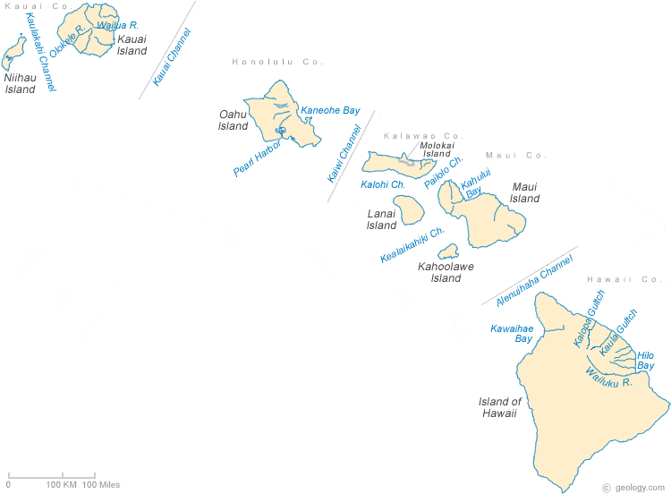
Hawaii Rivers Shown on the Map: Kalopa Gultch, Kaula Gultch, Olokele River, Wailua River and Wailuku River.
| Hawaii Stream and River Levels |
 The United States Geological Survey has a number of stream gages located throughout Hawaii. These estimate stream levels, discharges and record them over time. This data is published on the web and many stations allow users to plot custom graphs. Get updated Hawaii river and stream levels from USGS here.
| Hawaii Stream and River Level Alerts |
 The United States Geological Survey has a system that will send you an email message when flood levels are reached on any steam with USGS gaging equipment that you have selected. Sign up here to recieve Hawaii stream and river level alerts.
| Hawaii Water Publications |
 The United States Geological Survey has a number of publications related to water use and water resources in Hawaii. Visit the Pacific Islands Water Science Center here.

| Hawaii Waterfall: Akaka Falls |
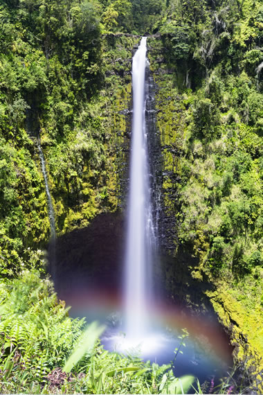 Akaka Falls is located in Akaka Falls State Park on the Big Island of Hawaii. It plunges 442 feet into a natural pool below. Sometimes a rainbow appears when the sun is shining brightly and the mist is heavy. Image copyright by iStockphoto / joebelanger.
| Hawaii Drought Map |
 The United States Geological Survey publishes updated drought maps on their website. There you can view a map that shows where below normal 7-day average stream flow conditions were recently recorded. The maps are updated daily. Get a current Hawaii drought map here.


Find Other Topics on Geology.com:

|

| ||

|

| ||

|

| ||

|

|