Home » Satellite Images » US States » Alaska
Satellite Image of Alaska
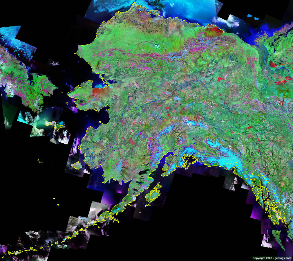
Alaska Satellite Image - View Cities, Rivers, Lakes & Environment
This is a Landsat GeoCover 2000 satellite image map of Alaska. Cities, rivers, lakes, mountains and other features shown in this image include:
Alaska Cities:
Anchorage, AK
Fairbanks, AK
Alaska Rivers, Lakes, Water Features:
Becharof Lake
Colville River
Copper River
Itkillik River
Kuskokwim River
Lliamna Lake
Mulchatna River
Sheenjek River
Yukon River
Other Prominent Alaska Features:
Alaska Range
Aleutian Islands
Baird Mountains
Bering Strait
Bristol Bay
Brooks Range
Cook Inlet
De Long Mountains
Endicott Mountains
Gulf of Alaska
Kilbuck Mountains
Kodiak Island
Kotzebue Sound
Kuskokwim Mountains
Malaspina Glacier
Norton Sound
Philip Smith Mountains
Shelikof Strait
Wrangall Mountains
ADVERTISEMENT
More Satellite Images
 State Satellite Images: Color Landsat views of all 50 states. Spectacular images.
 Use Google Earth for FREE: Browse seamless worldwide satellite images. Free.
 Earth from Space at Night: Composite images show worldwide patterns of night light and heat.
 Oil & Gas Fields from Space at Night: Drill pad lighting and flaring make them stand out at night.
 Country Satellite Images: Satellite images for over 170 countries from Landsat GeoCover data.
  Satellite Views of US Cities: Images of 120 cities and their surrounding environment.
 Land Below Sea Level: The top ten locations where land is below the level of the ocean.
  Satellite Views of 64 World Cities: Spectacular images showing the city and surrounding environment.
Copyright information: The images on this page were composed by Angela King and are copyright by Geology.com. These images are not available for use beyond our websites. If you would like to share them with others, please link to this page. The satellite image was produced using Landsat data from NASA.