Home » Satellite Images » US States

Satellite Images of US States (Landsat)


Nevada satellite image  Utah satellite image

 
U.S. city satellite images United States Cities
World country satellite images World Countries
World city satellite images World Cities
See the Earth at night Satellite Photos of Earth at Night
ADVERTISEMENT


Copyright information: Data used to produce the image above was provided by NASA's Earth Science Enterprise Scientific Data Purchase Program and produced, under NASA contract, by Earth Satellite Corporation. Thank you to those agencies for use of the data. The Landsat image was composed by Angela King and is property of Geology.com. Use of any Geology.com image without written permission is prohibited.
More Geology Topics
  General Geology
  Plate Tectonics
  Rocks
  Oil and Gas
  Fossils
  Astronomy
  Earthquakes
  Geologic Hazards

geology store

Find Other Topics on Geology.com:


Rocks
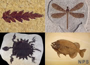
Rocks: Galleries of igneous, sedimentary and metamorphic rock photos with descriptions.
Minerals
Minerals: Information about ore minerals, gem materials and rock-forming minerals.
Volcanoes
Volcanoes: Articles about volcanoes, volcanic hazards and eruptions past and present.
Gemstones
Gemstones: Colorful images and articles about diamonds and colored stones.
General Geology
General Geology: Articles about geysers, maars, deltas, rifts, salt domes, water, and much more!
Geology Store
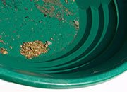
Geology Store: Hammers, field bags, hand lenses, maps, books, hardness picks, gold pans.
Earth Science Records
Earth Science Records: Highest mountain, deepest lake, biggest tsunami and more.
Diamond
Diamonds: Learn about the properties of diamond, its many uses, and diamond discoveries.