Home » Satellite Images » US States » North Carolina
Satellite Image of North Carolina
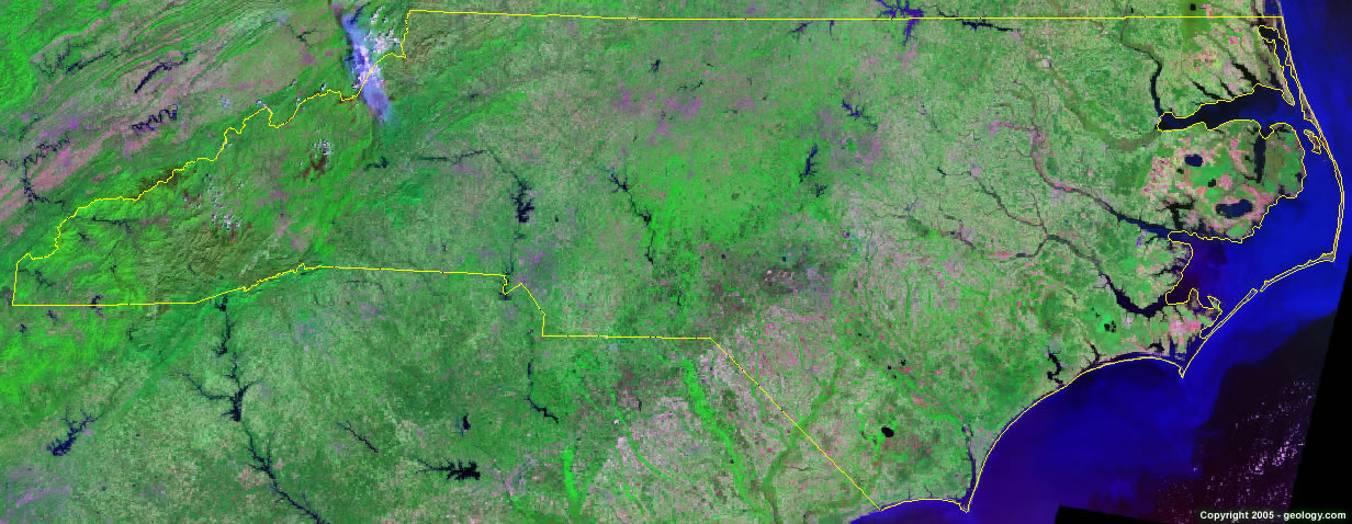
North Carolina Satellite Image - View Cities, Rivers, Lakes & Environment
Satellite Images for Neighboring States:
Georgia South Carolina Tennessee VirginiaThis is a Landsat GeoCover 2000 satellite image map of North Carolina. Cities, rivers, lakes, mountains and other features shown in this image include:
North Carolina Cities:
Asheville, NC
Burlington, NC
Charlotte, NC
Durham, NC
Fayetteville, NC
Gastonia, NC
Greensboro, NC
Hendersonville, NC
Hickory, NC
Jacksonville, NC
Raleigh, NC
Wilmington, NC
Winston-Salem, NC
North Carolina Rivers, Lakes, Water Features:
B. Everett Jordan Lake
Belews Lake
Catawba River
Chatuge Lake
Chowan River
Fontana Lake
Great Lake
Harris Lake
High Rock Lake
Hiwassee Lake
Hyco Lake
J. H. Kerr Reservoir
Lake Gaston
Lake James
Lake Mattamuskeet
Lake Norman
Lake Phelps
Lake Tillery
Lake Waccamaw
Neuse River
Roanoke River
Santeetlah Lake
Tar River
Yadkin River
Other Prominent North Carolina Features:
Albemarle Sound
Blue Ridge
Currituck Sound
Great Smoky Mountains
North Carolina farm land
Pamlico Sound
ADVERTISEMENT
More Satellite Images
 State Satellite Images: Color Landsat views of all 50 states. Spectacular images.
 Use Google Earth for FREE: Browse seamless worldwide satellite images. Free.
 Earth from Space at Night: Composite images show worldwide patterns of night light and heat.
 Oil & Gas Fields from Space at Night: Drill pad lighting and flaring make them stand out at night.
 Country Satellite Images: Satellite images for over 170 countries from Landsat GeoCover data.
  Satellite Views of US Cities: Images of 120 cities and their surrounding environment.
 Land Below Sea Level: The top ten locations where land is below the level of the ocean.
  Satellite Views of 64 World Cities: Spectacular images showing the city and surrounding environment.
Copyright information: The images on this page were composed by Angela King and are copyright by Geology.com. These images are not available for use beyond our websites. If you would like to share them with others, please link to this page. The satellite image was produced using Landsat data from NASA.