Home » Satellite Images » US States » Georgia
Satellite Image of Georgia
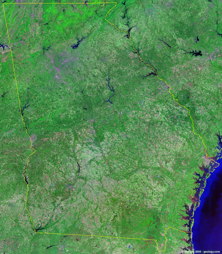
Georgia Satellite Image - View Cities, Rivers, Lakes & Environment
Satellite Images for Neighboring States:
Alabama Florida North Carolina South Carolina TennesseeThis is a Landsat GeoCover 2000 satellite image map of Georgia. Cities, rivers, lakes, mountains and other features shown in this image include:
Georgia Cities:
Albany, GA
Athens, GA
Atlanta, GA
Augusta, GA
Brunswick, GA
Columbus, GA
Dalton, GA
Fort Oglethorpe, GA
Gainesville, GA
Hinesville, GA
Macon, GA
Marietta, GA
Roswell, GA
Savannah, GA
Smyrna, GA
St. Simons Island, GA
Valdosta, GA
Warner Robins, GA
Georgia Rivers, Lakes, Water Features:
Allatoona Lake
Altamaha River
Banks Lake
Chattahoochee River
Chatuge Lake
Clark Hill Lake
Clarks Hill Lake
Flint River
Georgia Power Co. Reservoir
Hartwell Lake
Jackson Lake
Lake Burton
Lake Blackshear
Lake Hartwell
Lake Seminole
Lake Sidney Lanier
Lake Sinclair
Lake Stoney Lanier
Nottely Lake
Ocmulgee River
Oconee Lake
Oconee River
Russell Lake
Savannah River
St. Mary's River
Suwannee River
Walter F. George Reservoir
Wateree River
West Point Lake
Other Prominent Georgia Features:
Altamaha Sound
Chattahoochee National Forest
Cohutta Mountain
Cumberland Island
Fall Line
Georgia farm land
Jekyll Island
Lookout Mountain
Okefenokee Swamp
Ossabaw Sound
Pine Mountain
Sand Mountain
Sapelo Island
Sapelo Sound
St. Andrew Sound
St. Catherines Sound
St. Simons Island
Taylor Ridge
ADVERTISEMENT
More Satellite Images
 State Satellite Images: Color Landsat views of all 50 states. Spectacular images.
 Use Google Earth for FREE: Browse seamless worldwide satellite images. Free.
 Earth from Space at Night: Composite images show worldwide patterns of night light and heat.
 Oil & Gas Fields from Space at Night: Drill pad lighting and flaring make them stand out at night.
 Country Satellite Images: Satellite images for over 170 countries from Landsat GeoCover data.
  Satellite Views of US Cities: Images of 120 cities and their surrounding environment.
 Land Below Sea Level: The top ten locations where land is below the level of the ocean.
  Satellite Views of 64 World Cities: Spectacular images showing the city and surrounding environment.
Copyright information: The images on this page were composed by Angela King and are copyright by Geology.com. These images are not available for use beyond our websites. If you would like to share them with others, please link to this page. The satellite image was produced using Landsat data from NASA.