Home » Satellite Images » US States » South Carolina
Satellite Image of South Carolina
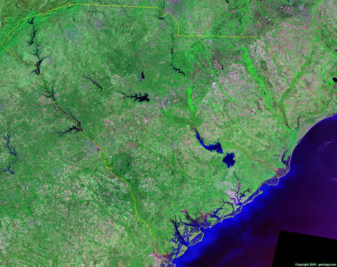
South Carolina Satellite Image - View Cities, Rivers, Lakes & Environment
Satellite Images for Neighboring States:
Georgia North CarolinaThis is a Landsat GeoCover 2000 satellite image map of South Carolina. Cities, rivers, lakes, mountains and other features shown in this image include:
South Carolina Cities:
Anderson, SC
Charleston, SC
Columbia, SC
Florence, SC
Gaffney, SC
Greenville, SC
Greenwood, SC
Hilton Head, SC
Myrtle Beach, SC
Newberry, SC
Rock Hill, SC
Spartanburg, SC
Sumter, SC
South Carolina Rivers, Lakes, Water Features:
Black River
Congaree River
Cooper River
Edisto River
Fishing Creek Reservoir
Hartwell Lake
J. Strom Thurmond Lake
Lake Greenwood
Lake Jocassee
Lake Keowee
Lake Marion
Lake Moultrie
Lake Murray
Lake Wateree
Lynches River
Monticello Reservoir
Par Pond
Pee Dee River
Russell Lake
Saluda River
Santee River
Savannah River
Tugaloo River
Wateree River
Other Prominent South Carolina Features:
Appalachian Mountains
Bulls Bay
Port Royal Sound
South Carolina farm land
St. Helena Sound
ADVERTISEMENT
More Satellite Images
 State Satellite Images: Color Landsat views of all 50 states. Spectacular images.
 Use Google Earth for FREE: Browse seamless worldwide satellite images. Free.
 Earth from Space at Night: Composite images show worldwide patterns of night light and heat.
 Oil & Gas Fields from Space at Night: Drill pad lighting and flaring make them stand out at night.
 Country Satellite Images: Satellite images for over 170 countries from Landsat GeoCover data.
  Satellite Views of US Cities: Images of 120 cities and their surrounding environment.
 Land Below Sea Level: The top ten locations where land is below the level of the ocean.
  Satellite Views of 64 World Cities: Spectacular images showing the city and surrounding environment.
Copyright information: The images on this page were composed by Angela King and are copyright by Geology.com. These images are not available for use beyond our websites. If you would like to share them with others, please link to this page. The satellite image was produced using Landsat data from NASA.