Home » Satellite Images » US States » Rhode Island
Satellite Image of Rhode Island
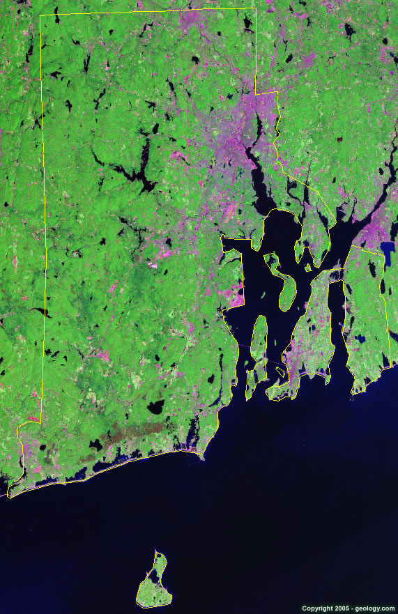
Rhode Island Satellite Image - View Cities, Rivers, Lakes & Environment
Satellite Images for Neighboring States:
Connecticut MassachusettsThis is a Landsat GeoCover 2000 satellite image map of Rhode Island. Cities, rivers, lakes, mountains and other features shown in this image include:
Rhode Island Cities:
East Providence, RI
Kingston, RI
Newport, RI
North Providence, RI
Pawtucket, RI
Providence, RI
Warwick, RI
West Warwick, RI
Westerly, RI
Woonsocket, RI
Rhode Island Rivers, Lakes, Water Features:
Barden Reservoir
Beach Pond
Bowdish Reservoir
Flat River Reservoir
Indian Lake
Pawtucket Reservoir
Pettaquamscutt River
Quidnick Reservoir
Sakonnet River
Scituate Reservoir
Seekonk River
Tiogue Lake
Wallum Lake
Westconnaug Reservoir
Woonsocket Reservoir
Worden Pond
Yawgoo Pond
Other Prominent Rhode Island Features:
Block Island Sound
Block Island
Conanicut Island
Greenwich Bay
Hope Bay
Narragansett Bay
Rhode Island farm land
Rhode Island Sound
Rhode Island
ADVERTISEMENT
More Satellite Images
 State Satellite Images: Color Landsat views of all 50 states. Spectacular images.
 Use Google Earth for FREE: Browse seamless worldwide satellite images. Free.
 Earth from Space at Night: Composite images show worldwide patterns of night light and heat.
 Oil & Gas Fields from Space at Night: Drill pad lighting and flaring make them stand out at night.
 Country Satellite Images: Satellite images for over 170 countries from Landsat GeoCover data.
  Satellite Views of US Cities: Images of 120 cities and their surrounding environment.
 Land Below Sea Level: The top ten locations where land is below the level of the ocean.
  Satellite Views of 64 World Cities: Spectacular images showing the city and surrounding environment.
Copyright information: The images on this page were composed by Angela King and are copyright by Geology.com. These images are not available for use beyond our websites. If you would like to share them with others, please link to this page. The satellite image was produced using Landsat data from NASA.