Home » Satellite Images » US States » Massachusetts
Satellite Image of Massachusetts
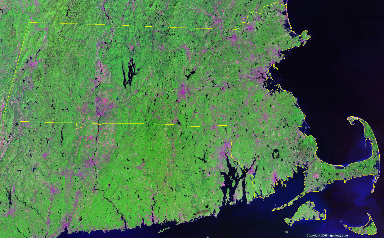
Massachusetts Satellite Image - View Cities, Rivers, Lakes & Environment
Satellite Images for Neighboring States:
Connecticut New Hampshire New York Rhode Island VermontThis is a Landsat GeoCover 2000 satellite image map of Massachusetts. Cities, rivers, lakes, mountains and other features shown in this image include:
Massachusetts Cities:
Attleboro, MA
Boston, MA
Brockton, MA
Cambridge, MA
Chicopee, MA
Fall River, MA
Fitchburg, MA
Framingham, MA
Gloucester, MA
Haverhill, MA
Holyoke, MA
Lawrence, MA
Lowell, MA
Marlborough, MA
New Bedford, MA
Newton, MA
Northampton, MA
Peabody, MA
Pittsfield, MA
Quincy, MA
Somerville, MA
Springfield, MA
Tauton, MA
Watertown, MA
Westfield, MA
Weymouth, MA
Worcester, MA
Massachusetts Rivers, Lakes, Water Features:
Assawomaset Pond
Cambridge Reservoir
Charles River
Cobble Mountain Reservoir
Connecticut River
Deerfield River
Great Quittacus Pond
Hoosic River
Long Pond
Merrimack River
Onota Lake
Otis Reservoir
Quabbin Reservoir
Wachusett Reservoir
Ware River
Westfield River
Worth Watuppa Pond
Other Prominent Massachusetts Features:
Cape Cod
Martha's Vineyard
Massachusetts farm land
Nantucket Island
Nantucket Sound
The Berkshires
ADVERTISEMENT
More Satellite Images
 State Satellite Images: Color Landsat views of all 50 states. Spectacular images.
 Use Google Earth for FREE: Browse seamless worldwide satellite images. Free.
 Earth from Space at Night: Composite images show worldwide patterns of night light and heat.
 Oil & Gas Fields from Space at Night: Drill pad lighting and flaring make them stand out at night.
 Country Satellite Images: Satellite images for over 170 countries from Landsat GeoCover data.
  Satellite Views of US Cities: Images of 120 cities and their surrounding environment.
 Land Below Sea Level: The top ten locations where land is below the level of the ocean.
  Satellite Views of 64 World Cities: Spectacular images showing the city and surrounding environment.
Copyright information: The images on this page were composed by Angela King and are copyright by Geology.com. These images are not available for use beyond our websites. If you would like to share them with others, please link to this page. The satellite image was produced using Landsat data from NASA.