Home » Satellite Images » US States » New York
Satellite Image of New York
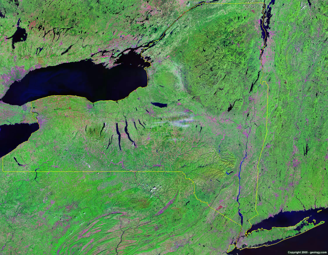
New York Satellite Image - View Cities, Rivers, Lakes & Environment
Satellite Images for Neighboring States:
Connecticut Massachusetts New Jersey Pennsylvania VermontThis is a Landsat GeoCover 2000 satellite image map of New York. Cities, rivers, lakes, mountains and other features shown in this image include:
New York Cities:
Albany, NY
Binghamton, NY
Buffalo, NY
Elmira, NY
Ithaca, NY
Jamestown, NY
Massena, NY
New York, NY
Plattsburgh, NY
Poughkeepsie, NY
Rochester, NY
Rome, NY
Schenectady, NY
Syracuse, NY
Utica, NY
Watertown, NY
West Glens Falls, NY
Yonkers, NY
New York Rivers, Lakes, Water Features:
Allegheny Reservoir
Allegheny River
Ashokan Reservoir
Canandaigua Lake
Canonsville Reservoir
Cayuga Lake
Chautauqua Lake
Cohocton River
Cranberry Lake
Erie Canal
Genesee River
Great Sacandaga Lake
Hudson River
Keuka Lake
Lake Champlain
Lake George
Lake Ontario
Lake Placid
Mohawk River
Oneida Lake
Otisco Lake
Otsego Lake
Owasco Lake
Papacton Reservoir
Raquette Lake
Salmon River Reservoir
Saranac Lake
Saratoga Lake
Seneca Lake
Skaneateles Lake
St. Lawrence
Other Prominent New York Features:
Adirondack Mountains
Catskill Mountains
Finger Lakes Region
Long Island
New York farm land
Shawangunk Mountains
ADVERTISEMENT
More Satellite Images
 State Satellite Images: Color Landsat views of all 50 states. Spectacular images.
 Use Google Earth for FREE: Browse seamless worldwide satellite images. Free.
 Earth from Space at Night: Composite images show worldwide patterns of night light and heat.
 Oil & Gas Fields from Space at Night: Drill pad lighting and flaring make them stand out at night.
 Country Satellite Images: Satellite images for over 170 countries from Landsat GeoCover data.
  Satellite Views of US Cities: Images of 120 cities and their surrounding environment.
 Land Below Sea Level: The top ten locations where land is below the level of the ocean.
  Satellite Views of 64 World Cities: Spectacular images showing the city and surrounding environment.
Copyright information: The images on this page were composed by Angela King and are copyright by Geology.com. These images are not available for use beyond our websites. If you would like to share them with others, please link to this page. The satellite image was produced using Landsat data from NASA.