Home » Satellite Images » US States » New Hampshire
Satellite Image of New Hampshire
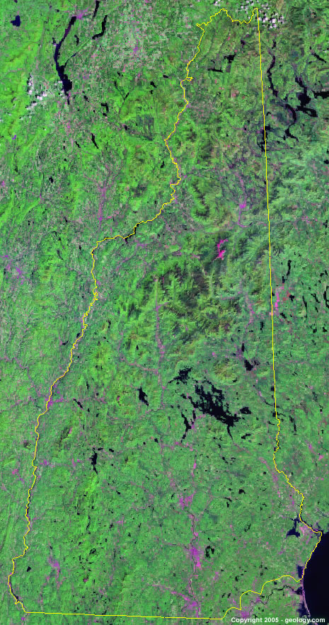
New Hampshire Satellite Image - View Cities, Rivers, Lakes & Environment
Satellite Images for Neighboring States:
Maine Massachusetts VermontThis is a Landsat GeoCover 2000 satellite image map of New Hampshire. Cities, rivers, lakes, mountains and other features shown in this image include:
New Hampshire Cities:
Berlin, NH
Claremont, NH
Concord, NH
Dover, NH
Keene, NH
Laconia, NH
Lebanon, NH
Manchester, NH
Nashua, NH
Plymouth, NH
Portsmouth, NH
Rochester, NH
White River Junction, NH
New Hampshire Rivers, Lakes, Water Features:
Androscoggin River
Connecticut River
Conway Lake
First Connecticut Lake
Goose Pond
Lake Francis
Lake Sunapee
Lake Winnipesaukee
Newfound Lake
Massabesic Lake
Merrimack River
Ossipee Lake
Second Connecticut Lake
Squam Lake
Umbagog Lake
Winnisquam Lake
Other Prominent New Hampshire Features:
Sandwich Range
White Mountains
ADVERTISEMENT
More Satellite Images
 State Satellite Images: Color Landsat views of all 50 states. Spectacular images.
 Use Google Earth for FREE: Browse seamless worldwide satellite images. Free.
 Earth from Space at Night: Composite images show worldwide patterns of night light and heat.
 Oil & Gas Fields from Space at Night: Drill pad lighting and flaring make them stand out at night.
 Country Satellite Images: Satellite images for over 170 countries from Landsat GeoCover data.
  Satellite Views of US Cities: Images of 120 cities and their surrounding environment.
 Land Below Sea Level: The top ten locations where land is below the level of the ocean.
  Satellite Views of 64 World Cities: Spectacular images showing the city and surrounding environment.
Copyright information: The images on this page were composed by Angela King and are copyright by Geology.com. These images are not available for use beyond our websites. If you would like to share them with others, please link to this page. The satellite image was produced using Landsat data from NASA.