Home » Satellite Images » US States » Idaho
Satellite Image of Idaho
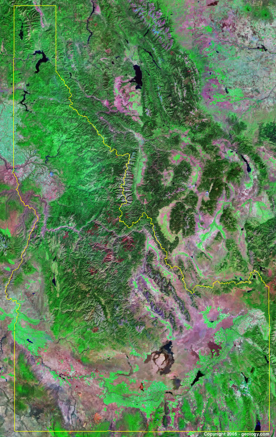
Idaho Satellite Image - View Cities, Rivers, Lakes & Environment
Satellite Images for Neighboring States:
Montana Nevada Oregon Utah Washington WyomingThis is a Landsat GeoCover 2000 satellite image map of Idaho. Cities, rivers, lakes, mountains and other features shown in this image include:
Idaho Cities:
Boise, ID
Coeur d' Alene, ID
grangeville, ID
Idaho Falls, ID
Moscow, ID
Pocatello, ID
Twin Falls, ID
Idaho Rivers, Lakes, Water Features:
American Falls Reservoir
Anderson Ranch Reservoir
Arrowrock Reservoir
Bear Lake
Blackfoot Reservoir
Boise River
Bruneau River
Cascade Lake
Clearwater River
Coeur d' Alene Lake
Coeur d' Alene River
Dworshak Reservoir
Grays Lake
Island Park Reservoir
Kootenai River
Lake Lowell
Lake Pend Oreille
Lake Pend
Lucky Peak Lake
Magic Reservoir
Orielle Lake
Owyhee River
Palisades Reservoir
Palouse River
Potlatch River
Priest Lake
Salmon River
Snake River
South Fork Boise River
St. Joe River
St. Maries River
Other Prominent Idaho Features:
Alvion Mountains
Bannock Range
Beaverhead Mountains
Bitterroot Range
Boise Mountains
Cabinet Mountains
Caribou Range
Centennial Mountains
Clearwater Mountains
Idaho farm land
Lemhi Range
Lost River Range
Owyhee Mountains
Pioneer Mountains
Salmon River Mountains
Sawtooth Range
Selkirk Range
Snake River Range
St. Joe Mountains
Sublett Range
Webster Range
West Mountains
ADVERTISEMENT
More Satellite Images
 State Satellite Images: Color Landsat views of all 50 states. Spectacular images.
 Use Google Earth for FREE: Browse seamless worldwide satellite images. Free.
 Earth from Space at Night: Composite images show worldwide patterns of night light and heat.
 Oil & Gas Fields from Space at Night: Drill pad lighting and flaring make them stand out at night.
 Country Satellite Images: Satellite images for over 170 countries from Landsat GeoCover data.
  Satellite Views of US Cities: Images of 120 cities and their surrounding environment.
 Land Below Sea Level: The top ten locations where land is below the level of the ocean.
  Satellite Views of 64 World Cities: Spectacular images showing the city and surrounding environment.
Copyright information: The images on this page were composed by Angela King and are copyright by Geology.com. These images are not available for use beyond our websites. If you would like to share them with others, please link to this page. The satellite image was produced using Landsat data from NASA.