Home » Satellite Images » US States » Montana
Satellite Image of Montana
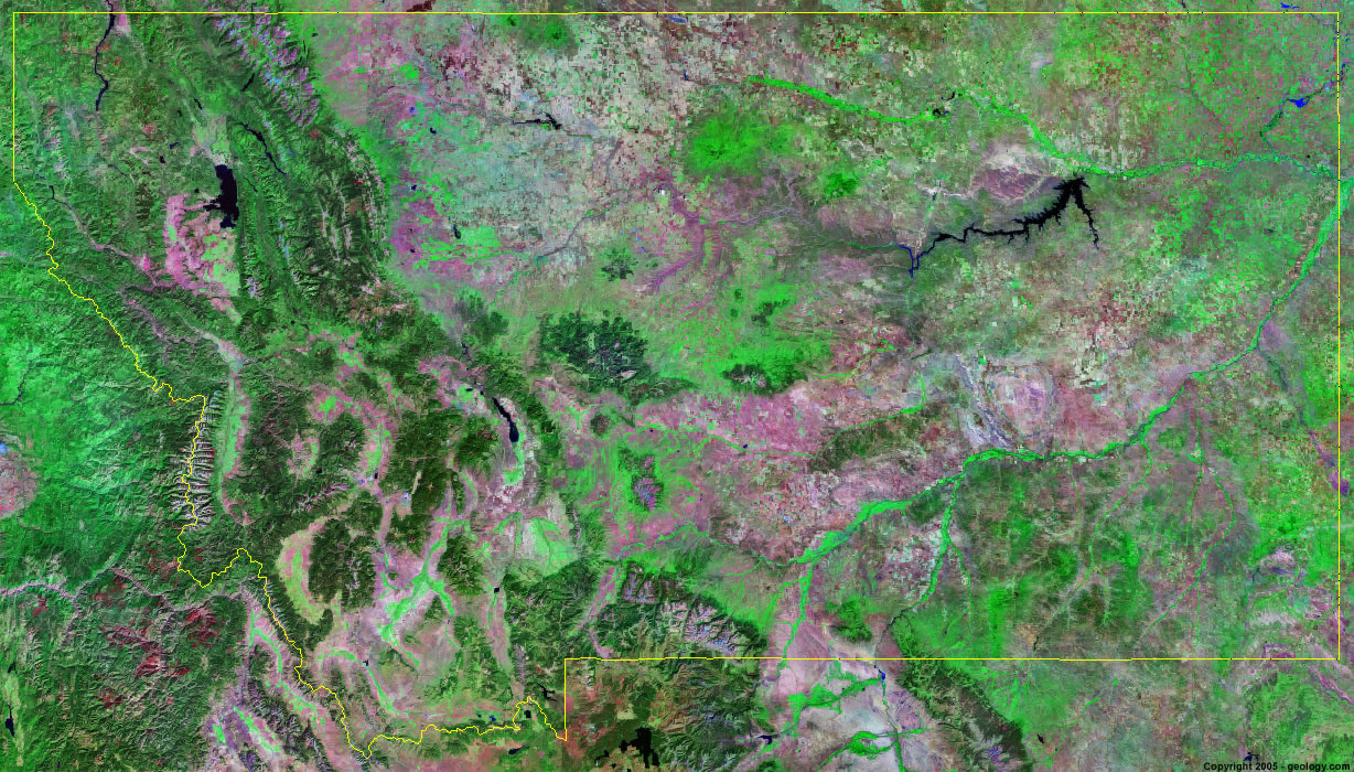
Montana Satellite Image - View Cities, Rivers, Lakes & Environment
Satellite Images for Neighboring States:
Idaho North Dakota South Dakota WyomingThis is a Landsat GeoCover 2000 satellite image map of Montana. Cities, rivers, lakes, mountains and other features shown in this image include:
Montana Cities:
Billings, MT
Bozeman, MT
Butte, MT
Great Falls, MT
Missoula, MT
Shelby, MT
Montana Rivers, Lakes, Water Features:
Bitterroot River
Bighorn River
Canyon Ferry Lake
Clark Fork
Ennis Lake
Flathead Lake
Fort Peck Lake
Freezout Lake
Hebgen Lake
Holter Lake
Hungry Horse Reservoir
Lake Elwell
Lake Koocanusa
Marias River
Medicine Lake
Milk River
Missouri River
Noxon Rapids Reservoir
Tongue River Reservoir
Yellowstone River
Other Prominent Montana Features:
Absaroka Range
Anaconda Range
Beaverhead Mountains
Big Belt Mountains
Big Snowy Mountains
Bighorn Mountains
Bitterroot Range
Cabinet Mountains
Centennial Mountains
Chalk Buttes
Coeur D' Alene Mountains
Crazy Mountains
Gallatin Range
Garnet Range
Glaciers in Glacier National Park
Gravelly Range
John Long Mountains
Little Belt Mountains
Madison Range
Mission Range
Montana farm land
Pioneer Mountains
Purcell Mountains
Rocky Mountains
Sapphire Mountains
Swan Range
Tobacco Root Mountains
Whitefish Range
ADVERTISEMENT
More Satellite Images
 State Satellite Images: Color Landsat views of all 50 states. Spectacular images.
 Use Google Earth for FREE: Browse seamless worldwide satellite images. Free.
 Earth from Space at Night: Composite images show worldwide patterns of night light and heat.
 Oil & Gas Fields from Space at Night: Drill pad lighting and flaring make them stand out at night.
 Country Satellite Images: Satellite images for over 170 countries from Landsat GeoCover data.
  Satellite Views of US Cities: Images of 120 cities and their surrounding environment.
 Land Below Sea Level: The top ten locations where land is below the level of the ocean.
  Satellite Views of 64 World Cities: Spectacular images showing the city and surrounding environment.
Copyright information: The images on this page were composed by Angela King and are copyright by Geology.com. These images are not available for use beyond our websites. If you would like to share them with others, please link to this page. The satellite image was produced using Landsat data from NASA.