Home » Satellite Images » US States » Colorado
Satellite Image of Colorado
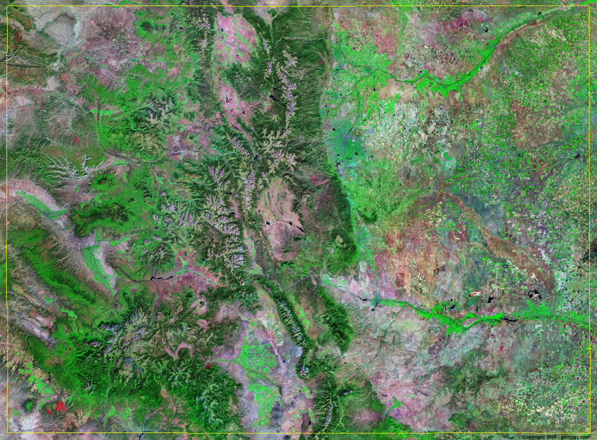
Colorado Satellite Image - View Cities, Rivers, Lakes & Environment
Satellite Images for Neighboring States:
Arizona Kansas Nebraska New Mexico Oklahoma Utah WyomingThis is a Landsat GeoCover 2000 satellite image map of Colorado. Cities, rivers, lakes, mountains and other features shown in this image include:
Colorado Cities:
Boulder, CO
Colorado Springs, CO
Denver, CO
Fort Collins, CO
Grand Junction, CO
Greeley, CO
Pueblo, CO
Colorado Rivers, Lakes, Water Features:
Adobe Creek Reservoir
Antero Reservoir
Arkansas River
Barr Lake
Blue Mesa Reservoir
Bonny Reservoir
Chatfield Reservoir
Cimarron River
Colorado River
Grand River
Gunnison River
Horse Creek Reservoir
Jackson Reservoir
John Martin Reservoir
Julesburg Reservoir
Lake Granby
Lake Meredith
Lake Pueblo
Little Snake River
McPhee Reservoir
Neenoshe Reservoir
Neesopan Reservoir
North Sterling Reservoir
Rio Grande
Riverside Reservior
San Luis Lake
South Platte River
Standley Lake
Taylor Park Reservoir
Twin Lakes
Waldon Reservoir
White River
Williams Fork Reservoir
Other Prominent Colorado Features:
Battlement Mesa
Colorado farm land
Culebra Range
Elk Mountains
Elkhead Mountains
Gore Range
Grand Mesa
La Garita Mountains
La Plata Mountains
Laramie Mountains
Medicine Bow Mountains
Park Range
Rampart Range
Roan Plateau
Rocky Mountains
Ruby Range
San Juan Mountains
San Luis Valley
Sangre De Christo Mountains
Sawatch Range
Sierra Madre Mountains
Tarryall Mountains
The Flat Tops
Uncompahgre Plateau
West Elk Mountains
Wet Mountains
Williams Fork Mountains
ADVERTISEMENT
More Satellite Images
 State Satellite Images: Color Landsat views of all 50 states. Spectacular images.
 Use Google Earth for FREE: Browse seamless worldwide satellite images. Free.
 Earth from Space at Night: Composite images show worldwide patterns of night light and heat.
 Oil & Gas Fields from Space at Night: Drill pad lighting and flaring make them stand out at night.
 Country Satellite Images: Satellite images for over 170 countries from Landsat GeoCover data.
  Satellite Views of US Cities: Images of 120 cities and their surrounding environment.
 Land Below Sea Level: The top ten locations where land is below the level of the ocean.
  Satellite Views of 64 World Cities: Spectacular images showing the city and surrounding environment.
Copyright information: The images on this page were composed by Angela King and are copyright by Geology.com. These images are not available for use beyond our websites. If you would like to share them with others, please link to this page. The satellite image was produced using Landsat data from NASA.