Home » Satellite Images » US States » Arizona
Satellite Image of Arizona
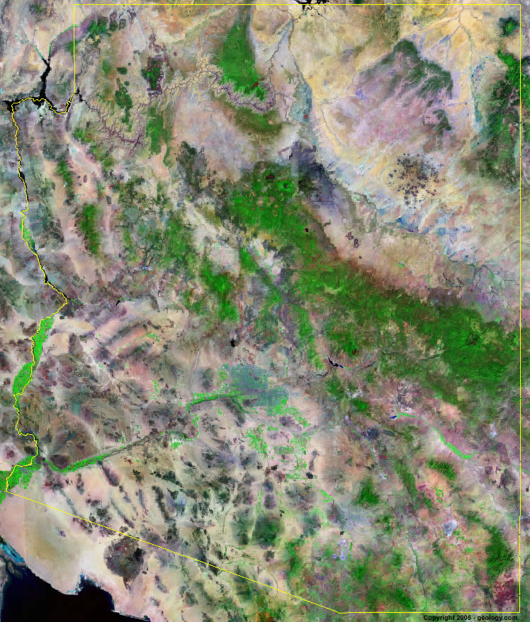
Arizona Satellite Image - View Cities, Rivers, Lakes & Environment
Satellite Images for Neighboring States:
California Colorado Nevada New Mexico UtahThis is a Landsat GeoCover 2000 satellite image map of Arizona. Cities, rivers, lakes, mountains and other features shown in this image include:
Arizona Cities:
Lake Havasu City, AZ
Page, AZ
Phoenix, AZ
Tucson, AZ
Yuma, AZ
Arizona Rivers, Lakes, Water Features:
Apache Lake
Bill Williams River
Colorado River
Gila River
Lake Havasu
Lake Mead
Lake Mohave
Lake Pleasant
Lake Powell
Little Colorado River
Mormon Lake
Salt River
San Carlos Reservoir
Theodore Roosevelt Lake
Other Prominent Arizona Features:
Bigbuc Mountains
Carrizo Mountains
Cerbat Mountains
Chiricahua Mountains
Coconino National Forest
Coconino Plateau
Coronado National Forest
Dos Cabezas Mountains
Gila Mountains
Grand Canyon
Growler Mountains
Harcuvar Mountains
Harquahala Mountains
Hopi Buttes
Hualpa Mountains
Kaibab National Forest
Mohawk Mountains
Painted Desert
Pinaleno Mountains
Prescott National Forest
San Francisco Mountains
Sitgreaves National Forest
Tonto National Forest
Yuma Desert
ADVERTISEMENT
More Satellite Images
 State Satellite Images: Color Landsat views of all 50 states. Spectacular images.
 Use Google Earth for FREE: Browse seamless worldwide satellite images. Free.
 Earth from Space at Night: Composite images show worldwide patterns of night light and heat.
 Oil & Gas Fields from Space at Night: Drill pad lighting and flaring make them stand out at night.
 Country Satellite Images: Satellite images for over 170 countries from Landsat GeoCover data.
  Satellite Views of US Cities: Images of 120 cities and their surrounding environment.
 Land Below Sea Level: The top ten locations where land is below the level of the ocean.
  Satellite Views of 64 World Cities: Spectacular images showing the city and surrounding environment.
Copyright information: The images on this page were composed by Angela King and are copyright by Geology.com. These images are not available for use beyond our websites. If you would like to share them with others, please link to this page. The satellite image was produced using Landsat data from NASA.