Home » Satellite Images » US States » Michigan
Satellite Image of Michigan
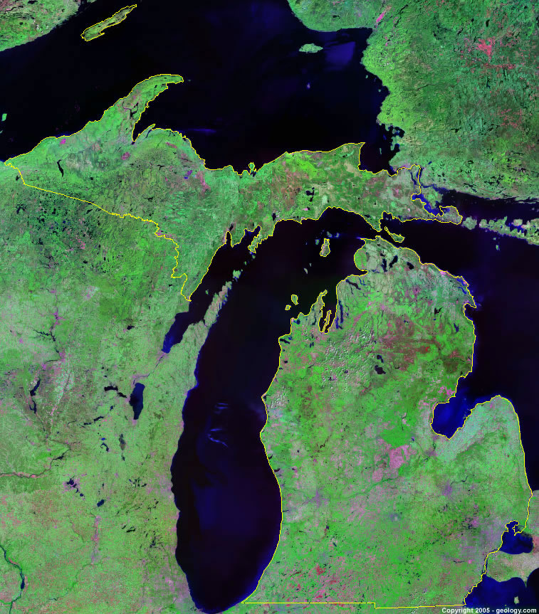
Michigan Satellite Image - View Cities, Rivers, Lakes & Environment
Satellite Images for Neighboring States:
Indiana Ohio WisconsinThis is a Landsat GeoCover 2000 satellite image map of Michigan. Cities, rivers, lakes, mountains and other features shown in this image include:
Michigan Cities:
Ann Arbor, MI
Battle Creek, MI
Bay City, MI
Detroit, MI
Flint, MI
Grand Rapids, MI
Holland, MI
Houghton, MI
Jackson, MI
Kalamazoo, MI
Lansing, MI
Lapeer, MI
Marquette, MI
Midland, MI
Muskegon, MI
Rogers City, MI
Saginaw, MI
Sault Ste. Marie, MI
St. Joseph, MI
Traverse City, MI
Michigan Rivers, Lakes, Water Features:
Au Sable River
Black Lake
Burt Lake
Detroit River
Elk Lake
Fletcher Pond
Grand River
Gull Lake
Higgins Lake
Houghton Lake
Hubbard Lake
Indian Lake
Kalamazoo River
Lake Erie
Lake Gogebic
Lake Huron
Lake Michigan
Lake St. Clair
Lake Superior
Manistique Lake
Mullet Lake
Muskegon River
Sanford Lake
St. Clair River
Torch Lake
Whitefish River
Wixom Lake
Other Prominent Michigan Features:
Manistee National Forest
Michigan farm land
Saginaw Bay
ADVERTISEMENT
More Satellite Images
 State Satellite Images: Color Landsat views of all 50 states. Spectacular images.
 Use Google Earth for FREE: Browse seamless worldwide satellite images. Free.
 Earth from Space at Night: Composite images show worldwide patterns of night light and heat.
 Oil & Gas Fields from Space at Night: Drill pad lighting and flaring make them stand out at night.
 Country Satellite Images: Satellite images for over 170 countries from Landsat GeoCover data.
  Satellite Views of US Cities: Images of 120 cities and their surrounding environment.
 Land Below Sea Level: The top ten locations where land is below the level of the ocean.
  Satellite Views of 64 World Cities: Spectacular images showing the city and surrounding environment.
Copyright information: The images on this page were composed by Angela King and are copyright by Geology.com. These images are not available for use beyond our websites. If you would like to share them with others, please link to this page. The satellite image was produced using Landsat data from NASA.