Home » Satellite Images » US States » Arkansas
Satellite Image of Arkansas
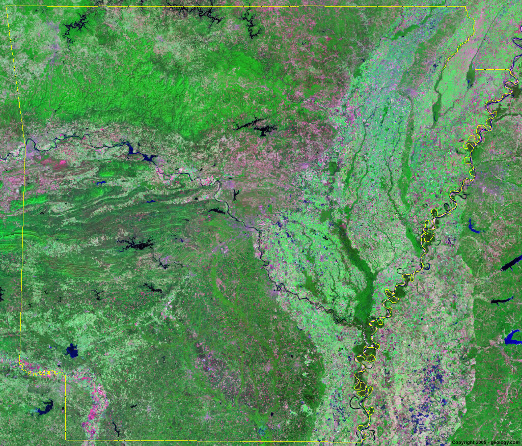
Arkansas Satellite Image - View Cities, Rivers, Lakes & Environment
Satellite Images for Neighboring States:
Louisiana Mississippi Missouri Oklahoma Tennessee TexasThis is a Landsat GeoCover 2000 satellite image map of Arkansas. Cities, rivers, lakes, mountains and other features shown in this image include:
Arkansas Cities:
Conway, AR
El Dorado, AR
Fayetteville, AR
Fort Smith, AR
Hot Springs, AR
Jonesboro, AR
Little Rock, AR
Magnolia, AR
Monticello, AR
Pine Bluff, AR
Rogers, AR
Russellville, AR
Springdale, AR
Texarkana, AR
Warren, AR
West Memphis, AR
Arkansas Rivers, Lakes, Water Features:
Arkansas River
Beaver Lake
Black River
Blue Mountain Lake
Buffalo River
Bull Shoals Lake
DeGray Lake
Greers Ferry Lake
Lake Catherine
Lake Conway
Lake Dardanelle
Lake Erling
Lake Greeson
Lake Jack Lee
Lake Maumelle
Lake Ouachita
Lake Winoma
Millwood Lake
Mississippi River
Nimrod Lake
Norfork Lake
Ouachita River
Ozark Lake
Red River
Saline River
St. Francis River
White River
Other Prominent Arkansas Features:
Arkansas farm land
Big Lake N.W.R.
Boston Mountains
Fort Chaffee
Ouachita Mountains
Ozark National Forest
Seven Devils Swamp
White River N.W.R.
ADVERTISEMENT
More Satellite Images
 State Satellite Images: Color Landsat views of all 50 states. Spectacular images.
 Use Google Earth for FREE: Browse seamless worldwide satellite images. Free.
 Earth from Space at Night: Composite images show worldwide patterns of night light and heat.
 Oil & Gas Fields from Space at Night: Drill pad lighting and flaring make them stand out at night.
 Country Satellite Images: Satellite images for over 170 countries from Landsat GeoCover data.
  Satellite Views of US Cities: Images of 120 cities and their surrounding environment.
 Land Below Sea Level: The top ten locations where land is below the level of the ocean.
  Satellite Views of 64 World Cities: Spectacular images showing the city and surrounding environment.
Copyright information: The images on this page were composed by Angela King and are copyright by Geology.com. These images are not available for use beyond our websites. If you would like to share them with others, please link to this page. The satellite image was produced using Landsat data from NASA.